Temperatures continue to heat up as we welcome June
We could see our first 90 degree highs since last fall this weekend with dry conditions expected
It was a very summer-like finish to the month of May across Central and Eastern Kentucky with more sunshine and afternoon highs climbing into the mid-80s. With enough moisture around and temperatures warming and mixing the air up, a few isolated storms fired up mainly across Southern and Western Kentucky so the bulk of the area was high and dry once again. Here in Lexington we saw our warmest day of May to close it out Wednesday with upper 80s and that will be a prelude of things to come to kick off June!

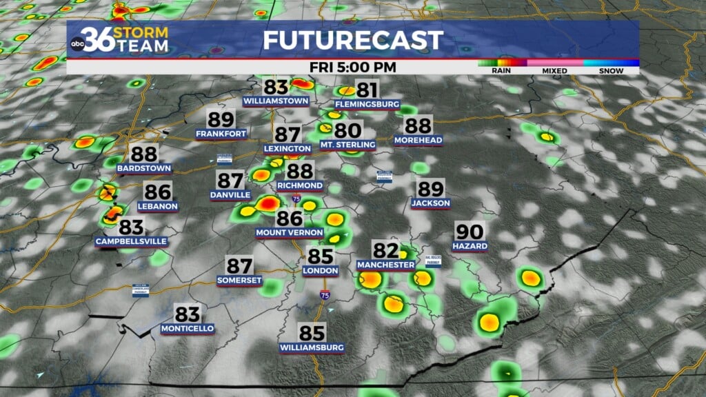
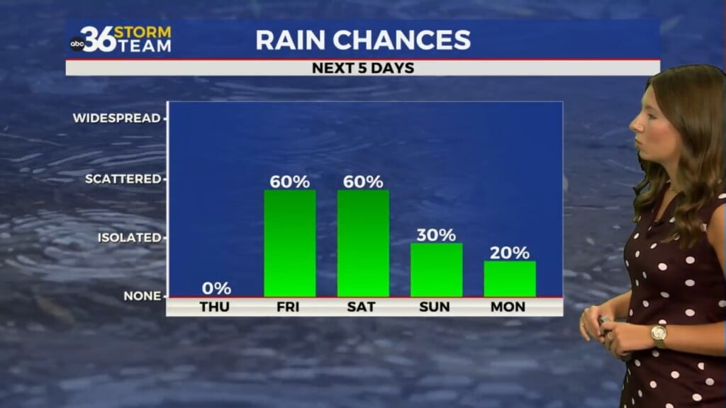
High pressure to our northeast will actually start to drift back to the southwest as we begin June and close out the week. This will help keep temperatures on the rise as afternoon highs nudge up a degree or two each day, topping out in the mid to upper 80s. We could still see a few isolated pop-up storms during the afternoon warmth before drier air begins to filter end on Friday.

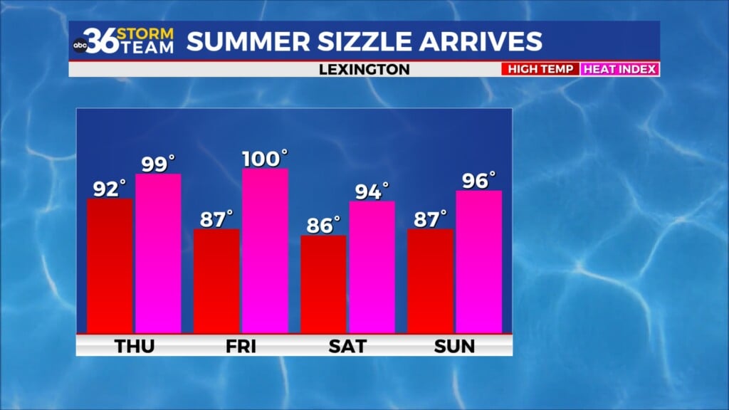
Get set for some toasty weather to kick off the weekend as the area of high pressure settles right into the heart of the Ohio Valley. Most locations should make a run at the 90 degree mark for afternoon highs, which would be the first time since last September we’ve had a legitimate shot to hit 90 degrees or above. The one thing that should help us out is the fact that it will be a “dry heat” for lack of a better term as an east to northeast wind keeps humidity levels low and the muggy air away. You’ll still need to hydrate properly if you’ll be out and about for all the outdoor activities going on around the Bluegrass.


The major model data has basically been in opposite camps the 24 to 36 hours regarding a trough and backdoor front digging through New England and into the Ohio Valley early next week. While the GFS had signaled a quick and significant cool-down, the European model wanted to hold off on that and slow things down. However the latest data seems to be coming more in-line with pushing some “cooler” air in for Sunday and into early next week as the high pressure and heat get push westward into the Central Plains. This would back our highs down to around 80 degrees by Monday with a few isolated storms possible as the front drops in. Stay tuned!

ABC 36 HOUR FORECAST
WEDNESDAY NIGHT: Mostly clear and pleasant. Lows in the low-60s.
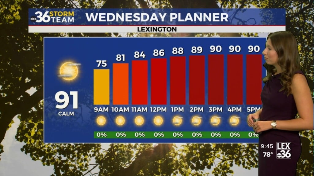
THURSDAY: Mostly sunny with isolated P.M. storms. Highs in the mid to upper-80s.
THURSDAY NIGHT: Mostly clear and mild. Lows in the low-60s.