Storm chances into the holiday weekend but the 4th is looking better
We could use the rain so it may be a balance with much needed rain Saturday and Sunday with a mainly dry holiday.
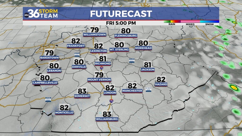
We kicked off the month of July on a hot and humid note with a few scattered and storms firing with the heating of the day. While the overall coverage was minimal, we did have some pockets of heavy rain in a few locations and we should pick up the pace a bit heading into the holiday weekend.

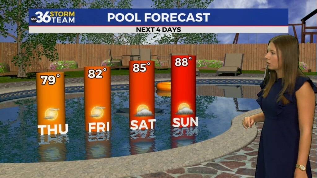
As the front stalls out over Kentucky and we get the afternoon warmth cranks up Saturday, expect more showers and storms with a bit more coverage. While we shouldn’t see a wash-out, you’ll need to keep the rain gear handy in case you get caught under a heavier downpour. The muggy air should stick around for much of the weekend, although we may get a brief break from it Sunday night as the departing wave of energy kicks in an easterly wind.


There is much better news for the 4th of July as the boundary that will stay stalled over the commonwealth the first part of the weekend lifts northward. As a result, we are looking at a mainly dry Independence Day with just an isolated storm possible and highs into the low 90s. Make sure and hydrate properly and use plenty of sun screen for your holiday celebrations Monday.


ABC 36 HOUR FORECAST
FRIDAY NIGHT: Warm and muggy, isolated storms. Lows in the low 70s.
SATURDAY: Hot and humid with scattered rain and storms. Highs in the upper 80s and low 90s.
SATURDAY NIGHT: Warm with more storms. Lows in the low 70s.