Storm chances diminish as drier air moves in to close out the week
With high pressure building in, our weather looks dry and pleasant across Central and Eastern Kentucky heading into the weekend
We got a break for the summer-like heat on Thursday across Central and Eastern Kentucky as a cold front moved through the region. While much of the area remained dry, a few scattered showers and storms with heavy downpours developed through the afternoon as the front dropped into Central Kentucky. With a few more clouds around, afternoon highs were down a bit into the upper 70s and low 80s.

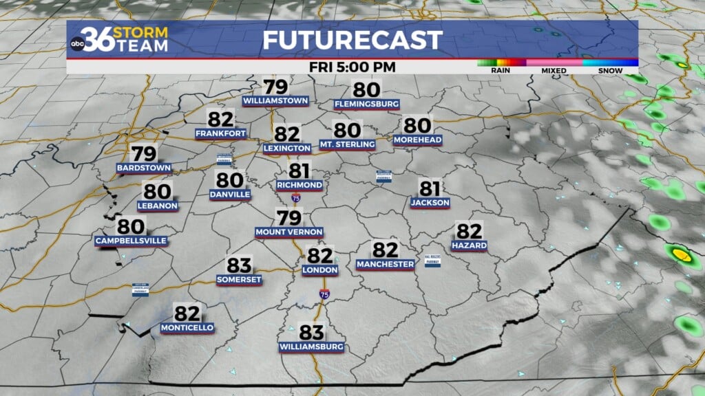
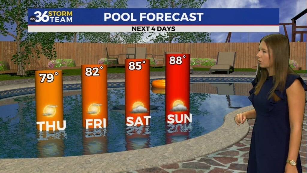
High pressure will usher in drier air to finish out the week on Friday so expect a pleasant day with a mix of clouds and sunshine. Humidity levels will drop back a bit as afternoon highs top out in the mid to upper 70s, which is slightly below average for the early part of June.

The upcoming weekend is still looking good as the area of high pressure holds serve as it drifts just to our east. With abundant sunshine, temperatures should be a touch warmer into the low 80s. Given that it’s the first weekend of June, make some outdoor plans and get out and enjoy the pleasant weather. Some of the data is still indicating that a late shower or storm may be possible into Sunday but I think most of the area will remain dry.

Our weather shifts back to a more unsettled pattern into early next week as several waves of energy/boundaries slide through the Ohio Valley. Right now it doesn’t look like a wash-out every day but our best chances for rain and storms may be on Monday and Wednesday. Stay tuned!

ABC 36 HOUR FORECAST
THURSDAY NIGHT: A few clouds and pleasant. Lows in the mid to upper 50s.
FRIDAY: Mostly sunny and nice. Highs in the mid to upper 70s.
FRIDAY NIGHT: Mostly clear, still comfy. Lows in the mid-50s.