Feeling more like summer to wrap up May
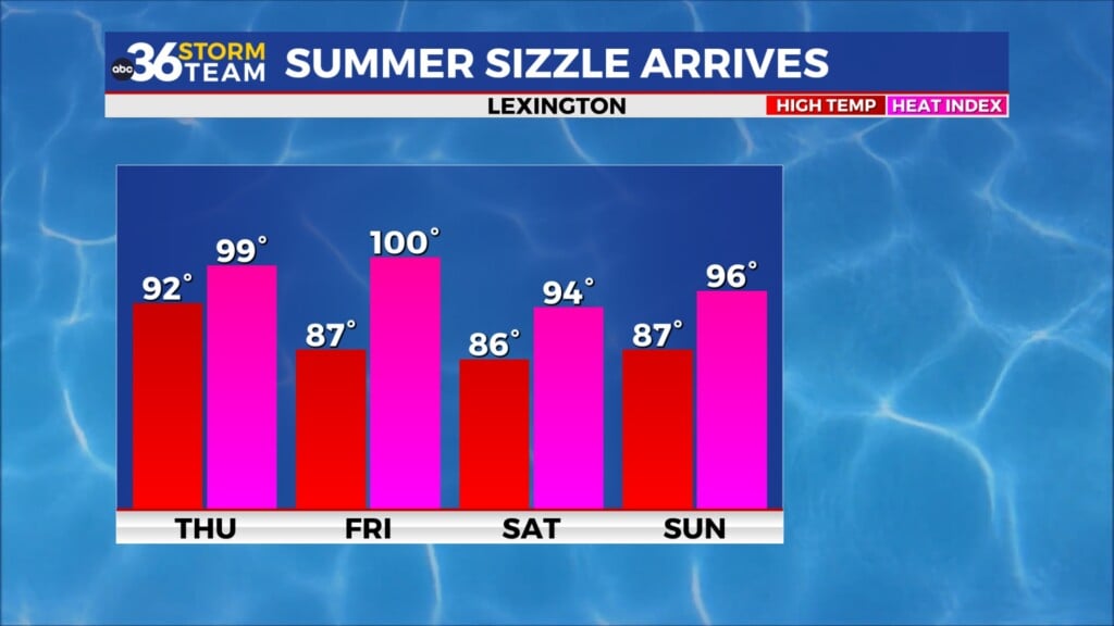
Afternoon highs will climb through the 80s the next couple of days with our first shot at 90 degree highs since last fall!
It was a nice late May day across Central and Eastern Kentucky on Tuesday as folks headed back to work and normal schedules after the long holiday weekend. After starting out with full sunshine in the morning, a few scattered clouds developed as temperatures warmed up through the afternoon hours. With some lingering moisture due to the upper low to our east, a spotty shower or two popped up but it was nothing major as highs climbed into the low and mid-80s. It definitely was a fantastic start to the day with some beautiful sunrise pictures.

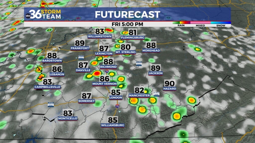
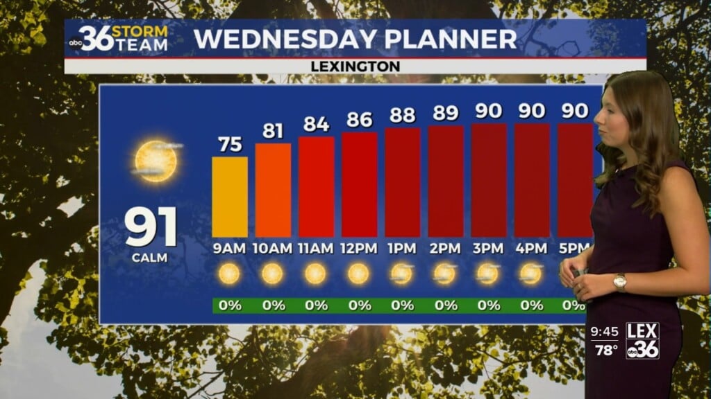
We’ll see more of the same to close out May on Wednesday as the sunshine rules and afternoon highs make a run for the mid-80s in most locations. Just like Tuesday, there will still be a bit of moisture aloft and with the afternoon warming a few isolated pop-ups can’t be ruled out although most locations should stay dry.

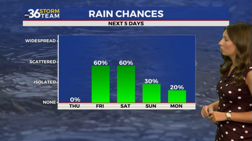
Kicking off June on Thursday our upward trend of temperatures will continue with highs running into the mid and possibly a few upper 80s. This will be our last day of the isolated late afternoon storm threat as some drier air begins to build in on Friday and hang around for the upcoming weekend.

Speaking of the drier air, a ridge of high pressure over New England will actually slide southwestward into the weekend pushing the moisture out of the region and eliminating our isolated storm chances. With the dry air in place, this will allow temperatures to really heat up so highs are going to push the 90 degree mark in several spots. The good news is that the air will be dry so while it will be hot but not overly humidity so it should be an ideal first weekend of June with all the outdoor events in and around Lexington metro! Temperatures will level off with a bit of moisture creeping back as a frontal boundary tries to drop in from the north early next week!

ABC 36 HOUR FORECAST
TUESDAY NIGHT: Mostly clear and pleasant. Lows in the low-60s.
WEDNESDAY: Mostly sunny with isolated P.M. storms. Highs in the mid-80s.
WEDNESDAY NIGHT: Mostly clear and mild. Lows in the low-60s.