Rain chances ramp up into the late week
After some pleasant spring weather the last few days, an area of low pressure will bring some healthy rainfall totals to the area into Friday
We enjoyed a delightful Wednesday across Central and Eastern Kentucky, even with a weak frontal boundary dropping through the area. This front did nothing more than shift our winds to the northeast and produce a few scattered afternoon clouds. Most locations enjoyed plenty of sunshine and overachieving highs will temperatures topping out into the upper 60s with a few low 70s sprinkled in. Hopefully you’ve enjoyed the dry weather of late as some changes are headed our way to end the week.

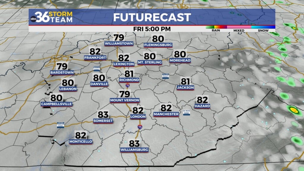
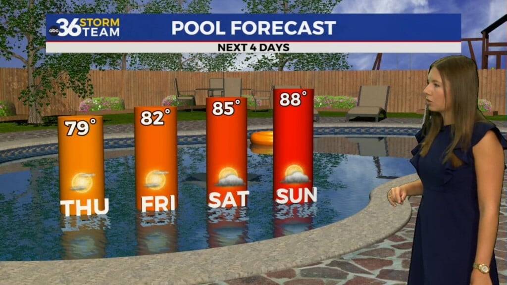
A wave of low pressure to our southwest will spin toward the Ohio Valley on Thursday will our rain chances increasing as the day wears on. We should start out with dry conditions and temperatures climbing out of the 40s in the morning but by the afternoon hours the moisture will increase significantly so you’ll need the rain gear later in the day. The heaviest and most widespread rain looks to fall into the early hours Friday before winding down to a few scattered showers closing out the week Friday. Highs should reach the upper 60s Thursday with readings around 70 degrees on Friday. Rainfall totals should range anywhere between .50″ and upwards of 1.5″ in a few locations so a good soaker is expected.


Heading into the weekend, we’ll be in between systems on Saturday so it should be a mainly dry day with afternoon highs in the upper 60s to around 70 degrees. A frontal boundary will drop in Sunday with a few spotty showers possible but the bigger story will be a shot of some unseasonably cool air as we welcome the month of May on Monday. Temperatures will struggle through the 50s to begin Derby week but should moderate fairly quickly. We may have to dodge a few showers with a northwest flow coming around an upper level low to our north on Monday.


ABC 36 HOUR FORECAST
WEDNESDAY NIGHT: A few clouds, still cool. Lows in the mid-40s.
THURSDAY: Clouds increase, afternoon rain . Highs in the mid to upper-60s.
THURSDAY NIGHT: Occasional rain and breezy. Lows in the mid-50s.