More humidity and storms before we catch a brief break this weekend
A few of the storms could be strong on Friday as a wave of energy drags a cool front through the commonwealth
It’s been a hot and humid first week of July across Central and Eastern Kentucky and Thursday was no exception, although we did catch a bit of a silver lining with some scattered cloud cover, which helped keep afternoon highs into the upper 80s and low 90s for most locations. Much of the thunderstorm activity was confined to areas south and west of Lexington but that may not be the case into Friday.

A wave of energy is expected to slide through the heart of the Bluegrass to end the week on Friday, dragging a cold front along with it. This should set the stage for a potential thunderstorm complex or cluster of storms to develop and move into our area. With a little more spin in the atmosphere thanks to the low passing by, the Storm Prediction Center has upgraded Central Kentucky into a Level 2 (out of 5) severe weather risk for Friday with a Level 1 risk farther south. While damaging winds should be the primary threat, the isolated tornado chance is in play with this system with the turning of the winds aloft. Heavy rain should accompany any storms that do develop.


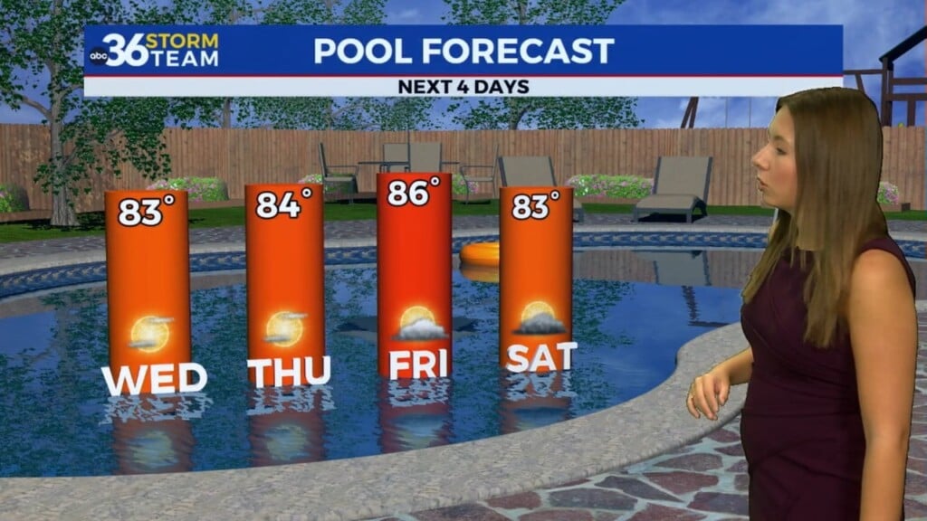
The good news for the weekend is the break from the heat expected as the frontal boundary drops just to our south. This will allow high pressure to build into the Great Lakes and set us up for a really nice Sunday with dry conditions, a little less humid and comfortable highs in the mid-80s. The break from the humidity will be brief, mainly early on Sunday before we get back into the same July weather routine early next week as another frontal system brings the chance of a few storms along with hot and more humid conditions.


ABC 36 HOUR FORECAST
THURSDAY NIGHT: Warm and muggy, isolated storms. Lows in the low and mid-70s.
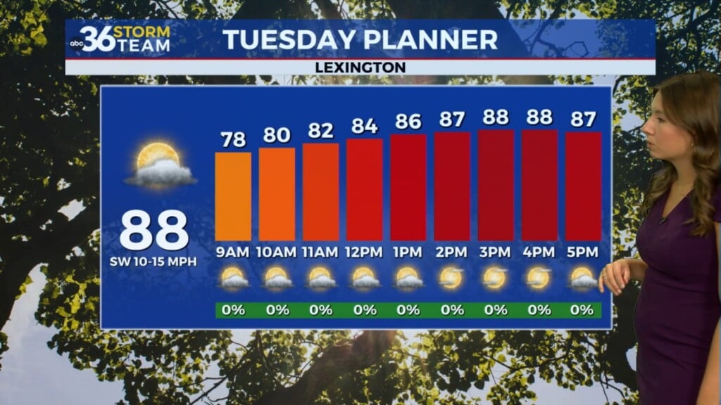
FRIDAY: Humid with scattered rain and storms. Highs in the upper 80s.
FRIDAY NIGHT: Warm with showers and storms. Lows in the low-70s.