A nice start to the weekend but rain and storms now return by Sunday
Enjoy the beautiful weather Saturday as our next storm system picks up speed and ups our storm chances to end the weekend
Despite some linger haze/smoke from the Eastern Canada wildfires hanging in the air across Central and Eastern Kentucky it was a nice way to finish out the week on Friday. With high pressure building into the Ohio Valley there was plenty of sunshine as afternoon highs worked into the upper 70s to around 80 degrees. Those pretty sunrise and sunset pictures keep pouring in thanks to all the hazy skies lately.


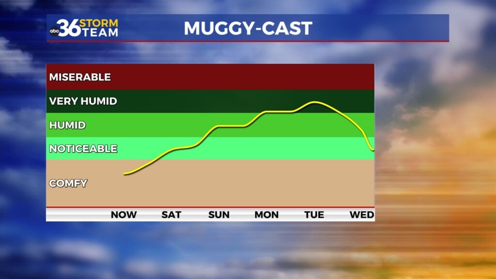
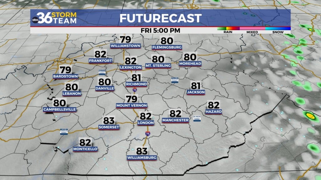
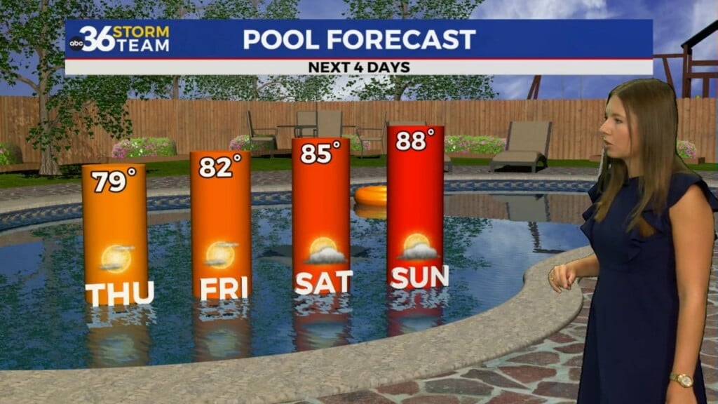
Heading into the weekend, it looks great on Saturday with sunshine and afternoon highs into the low 80s in most locations. This will definitely be your day to enjoy outdoor activities as the haze will begin to diminish and humidity levels shouldn’t be overly high. It will be just about perfect for early to mid-June and you’ll want to take advantage given the chances on the way to close out the weekend.

It now appears the storm system that we hoped would hold off until late Sunday has now picked up speed and should arrive earlier on Sunday. In fact we could see a couple of rounds of rain. One in the morning as the warm front arcs through, then another round with storms included just ahead of the cold front late on Sunday. While the best chance for organized strong storms is just to our west, we could see a few decent boomers here in Central and Eastern Kentucky. We are under a Level 1 risk (out of 5) from the Storm Prediction Center on Sunday with damaging winds and heavy rain being the primary threats.


Speaking of heavy rain, we could see some decent rainfall totals out of this system, especially those areas that catch some heavy downpours. A widespread .50″ to 1″ rainfall is possible with isolated spots seeing more. This is great news considering our latest Drought Monitor has much of Central and Southern Kentucky in the “Moderate Drought” so hopefully the additional rain expected helps out. Things should quiet down for a few days next week before isolated storms return to the mix with highs recovering into the mid-80s late next week. Have a great weekend!


ABC 36 HOUR FORECAST
FRIDAY NIGHT: Clear skies and pleasant. Lows in the low-50s.
SATURDAY: Mostly sunny and warm. Highs in the low-80s.
SATURDAY NIGHT: A few clouds and mild. Lows in the upper-50s and low-60s.