Canadian wildfire smoke makes a brief return with heat, humidity, and storms set to return
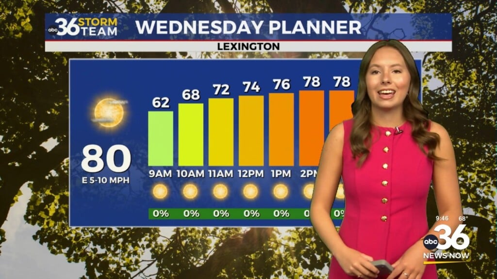
Even though some smoke/haze will hang around Wednesday, it should be a decent day with sunshine and highs into the mid-80s
We’ve seen multiple rounds of it the last month across Central and Eastern Kentucky so it was no surprise to see a return of the smoke and haze from the on-going wildfires across Eastern Canada. With high pressure to our northwest and low pressure to our northeast, that put the Ohio Valley in the prime spot for another wave of smoke particles to settle in. This batch will hang around into Wednesday before dissipating heading into Thursday. Once again, the smoke and haze made for some beautiful sunrise shots to kick off the day.


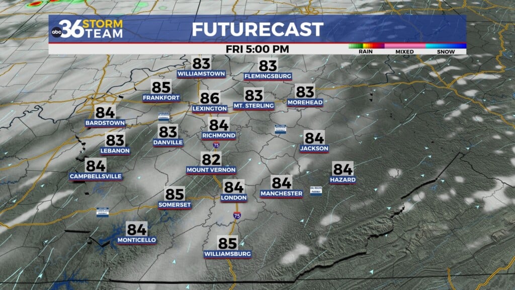
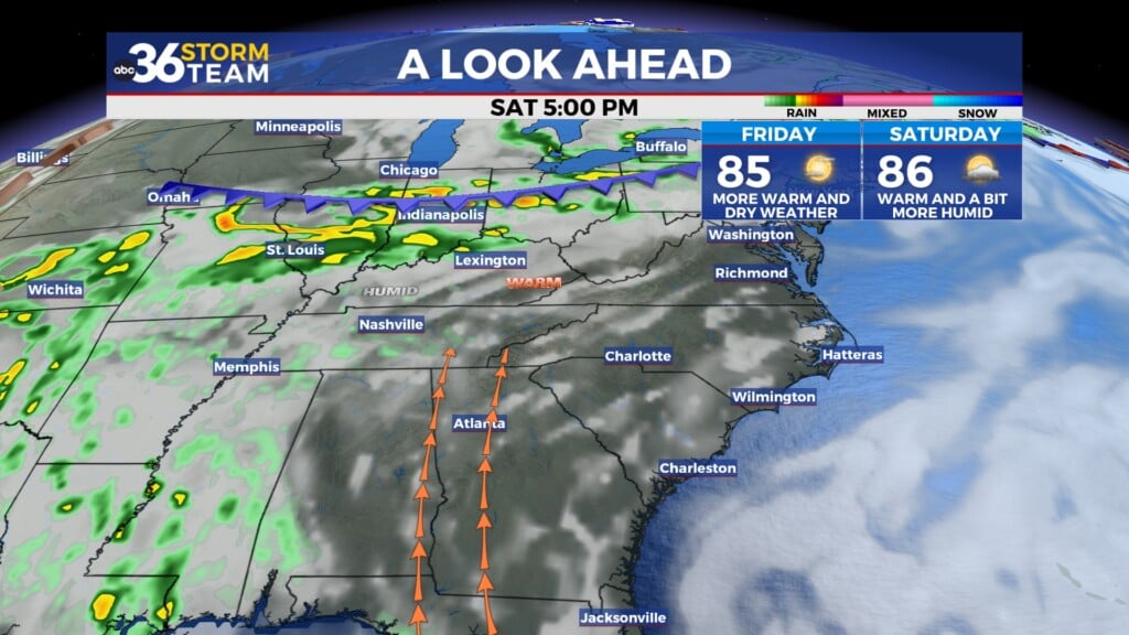
Despite the smoke and haze hanging around, it should be a fairly nice day on Wednesday with more sunshine (even though it will be hazy) and afternoon highs creeping up a bit. Most locations will top out into the mid-80s, which is right around average for late June. Humidity levels will be manageable so enjoy the good weather as we’ve got some changes on the way late week.

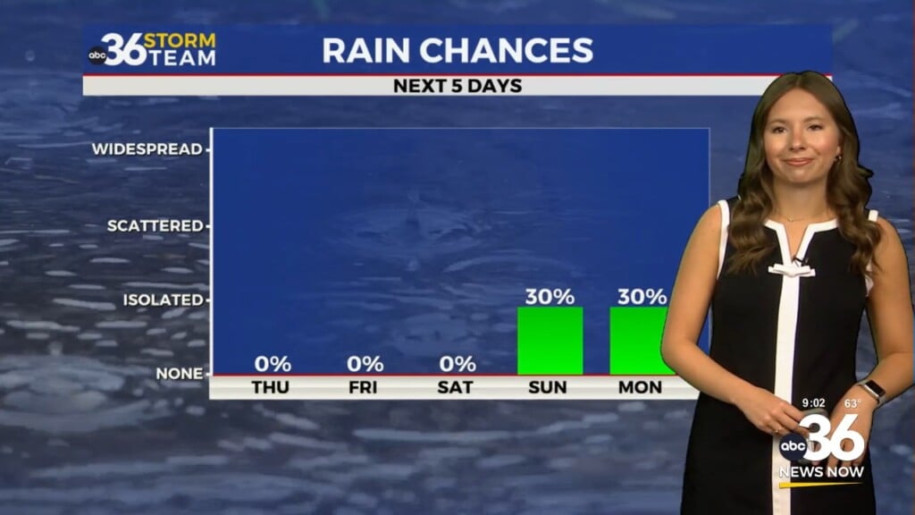
The big ridge of heat and humidity that has been plaguing the Southern Plains for a few weeks will begin to shift to the east slightly, putting the Ohio Valley in the cross hairs for a return of hot and humid weather but also the possibility of a few “thunderstorm complexes” impacting our area late week. How it works is that the bubble of heat prevent any storms from penetrating the ridge, so storms develop across the Upper Midwest and “ride the ridge” down into our area. These storms have the potential to produce heavy rain and possibly some strong storms given the amount of moisture that will be available. We’ll have to keep an eye on Thursday night and again on Friday for the severe weather potential. The other issue is heat and humidity as highs will head into the low 90s with heat indices at or above 100 degrees to close out June. We could see our first Heat Advisory of the summer so keep that in mind.


More unsettled weather will be on tap to kick off July with scattered storms and slightly “cooler” temperatures by Sunday into the mid-80s as a cold front moves through. The good news is that the storm chances should be less heading into the 4th of July holiday next Tuesday with highs into the upper 80s!

ABC 36 HOUR FORECAST
TUESDAY NIGHT: Hazy skies and quiet. Lows in the upper 50s and low-60s.
WEDNESDAY: Hazy sunshine and warmer. Highs in the mid-80s.
WEDNESDAY NIGHT: A few clouds and mild. Lows in the mid-60s.