A few flurries, yes flurries possible early Tuesday as unseasonably colder air moves in
The snowflakes shouldn't amount to anything but will be a reminder that winter is right around the corner
As expected it was a breezy and cooler start to the week across Central and Eastern Kentucky Monday with afternoon struggling into the mid to upper 50s despite plenty of sunshine. Add a brisk west wind gusting in the 20 to 25 miles per hour range, it felt like a fall day! Speaking of autumn, the fall foliage around the area is really starting to hit peak so enjoy it while it lasts, especially with all the wind blowing many of the leaves off the trees.
Mother Nature will gives us a friendly reminder that winter is just around the corner heading into Tuesday. For starters, the coldest air of the season will drift in so Freeze Warnings are up across the board for Tuesday morning. The only fly in the ointment is clouds and some low level moisture that will stream down from the Great Lakes. This will do two things: 1) bring a few scattered flurries early Tuesday…yes flurries!…and 2) the clouds could act as a “blanket” enough to prevent a hard freeze here in Central and Eastern Kentucky. However if it doesn’t happen Tuesday, the growing season will end Wednesday and Thursday morning as skies clear and temperatures drop into the upper 20s.
As high pressure drifts through the region and to our southeast by later this week, expect tranquil conditions but it will still be unseasonably cool as afternoon highs creep back into the upper 50s by Thursday. Keep in mind with another stretch with no rain, the current dry conditions and some breezy days ahead, an elevated fire danger will be with us later this week. A simple burning cigarette butt discarded into dry grass can cause some big issues and start a problematic fire.
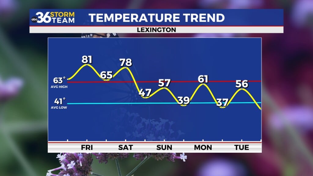
You know how things are across Central and Eastern Kentucky with our up and down weather and the next 7 days will be a classic example of that. After those cool days through the mid-week, the return flow around high pressure and a dry warm front moving through, temperatures will surge into the mid and upper 70s by the end of the weekend! So the roller coaster ride will continue! Don’t forget about those heavier jackets Tuesday morning.
ABC 36 HOUR FORECAST
MONDAY NIGHT: Breezy and cold, flurries late. Lows in the upper 20s and low 30s.
TUESDAY: A.M. flurries, then scattered clouds, breezy and chilly. Highs in the mid to upper 40s.
TUESDAY NIGHT: Clearing skies, breezy and cold. Lows in the upper 20s.


