Oppressive heat and humidity relaxes a bit this weekend
After heat indices around 110 degrees with highs in the mid-90s Friday, we should back off on the very hot air by Sunday
We managed to avoid the excessive heat and humidity for much of the week across Central and Eastern Kentucky but our luck finally ran out on Friday. With super high humidity as dew-points reached the mid to upper 70s couples with afternoon highs in the mid and upper 90s, we dealt with some very oppressive conditions as heat index values ran in between 110 to 115 degrees here in the Bluegrass with readings between and 100 and 105 degrees in the east. We saw our hottest day of 2023 in Lexington as the afternoon high reached 98 degrees. With all that hot and muggy air around plus a leftover boundary from early morning storms to our east, clusters of thunderstorms fired quickly across Eastern Kentucky producing gusty to damaging winds, torrential rain and lots of lightning. Even though it was quite sticky to be out early, it was a pretty and quiet start to the day in most locations.

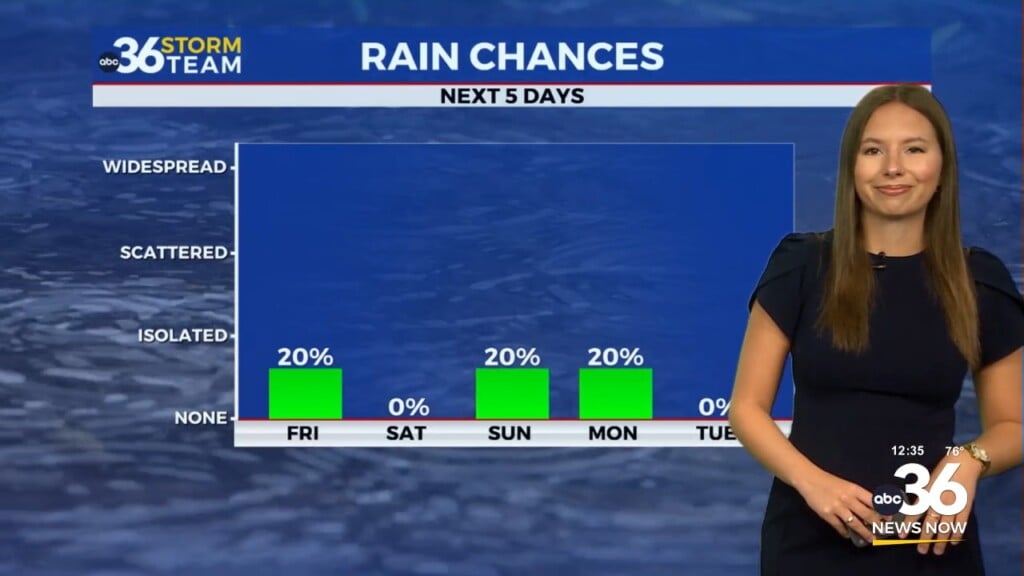
With a frontal boundary dropping through the Ohio Valley and a wave of low pressure riding along it, our chances for scattered storms will continue as we head into the weekend on Saturday. While it shouldn’t be a wash-out, be prepared to dodge a few showers and storms from time to time. With the front draped across the southern part of the state, winds will shift to the northwest, which should begin to knock humidity levels down a bit but it should still be a rather warm to hot day with afternoon highs in the upper 80s to right around 90 degrees. There is a Level 1 severe risk (out of 5) for areas of Southern and Eastern Kentucky with damaging winds being the primary threat.


Once the front clears the area into Sunday, we will finally dry and and cool down with afternoon highs backing down into the mid-80s to kick off next week. The biggest bonus is that humidity level will take a dive as our “muggy meter” drops back into the comfy range for a few days. As we close out August into the middle of next week another mainly dry front will being an unseasonably mild shot of air to the region as highs stay very comfortable in the upper 70s with morning lows in the 50s!


ABC 36 HOUR FORECAST
FRIDAY NIGHT: Warm and muggy with a few storms. Lows in the low-70s.
SATURDAY: Mostly sunny with scattered storms. Highs in the upper-80s to around 90 degrees.
SATURDAY NIGHT: Partly cloudy with a stray storm south. Lows in the upper-60s.