Our break from the heat and humidity hangs around to begin August
Temperatures should be right around average into the mid-week with another round of smoke/haze drifting into the area
We enjoyed a nice finish to the month of July across Central and Eastern Kentucky on Monday with the only exception being far southeast Kentucky as a few storms popped up along a weak boundary. Elsewhere it was delightful with afternoon highs into the low and mid-80s and more importantly dew-point temperatures were greatly reduced compared to last week with comfy readings into the upper 50s and low 60s.

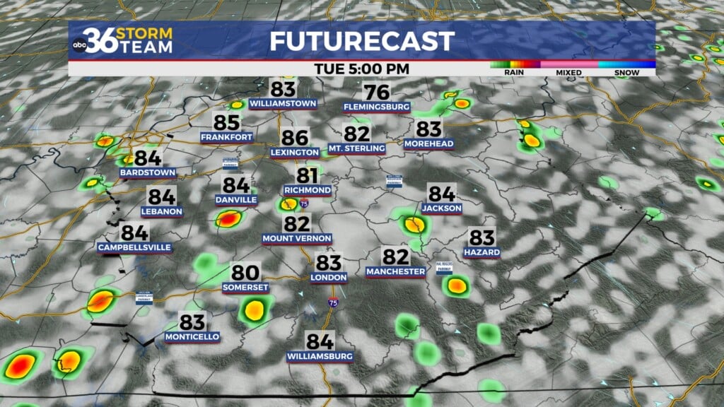
The pleasant summer weather will roll along as we kick off August on Tuesday thanks to high pressure hanging just to our north. We should enjoy a comparable day to Monday, with afternoon highs once again reaching the low to mid-80s and low humidity levels adding to a comfortable start to the month.

The only speed bump through the mid-week will be a return of some of the haze/smoke from the on-going Canadian wildfires to our north. As we have seen on a number of occasions the last few months, when we see a general northeast flow aloft, this allows plumes of elevated smoke to drift into our area. Right now based on the latest data the best chances for the haze will be on Wednesday for those locations from Lexington along I-64 to the east and points north of there.

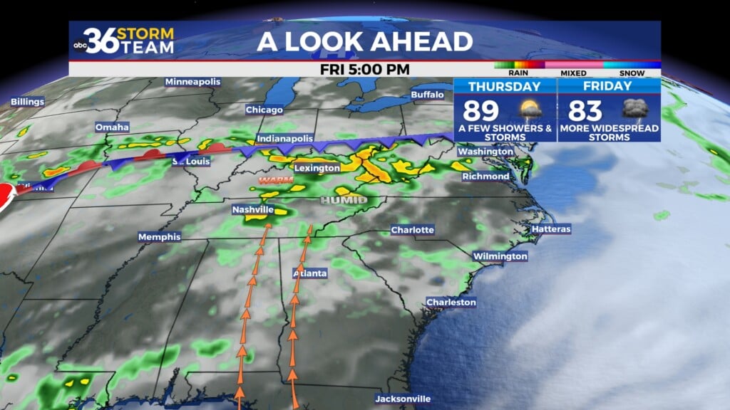
It will feel more like early August as the muggy air makes a return to the Ohio Valley beginning Thursday. High pressure will settle over New England allowing a return flow from the south to push the moisture and humidity back into the commonwealth. With a warm front to our west, rounds of thunderstorms may develop to our west and northwest before riding southeastward into our area. This will bring a return of storm chances to the area, which should continue into the first weekend of August as a few waves of energy roll through. Highs will be right around average for early August topping into the upper 80s this weekend.


ABC 36 HOUR FORECAST
MONDAY NIGHT: Mostly clear and pleasant. Lows in the upper 50s and low 60s.
TUESDAY: Mostly sunny and warm. Highs in the mid-80s.
TUESDAY NIGHT: Mostly clear and quiet. Lows in the low-60s.