One more dry day before a return to more active and unsettled weather
While it shouldn't be a wash-out on any particular day, the rain gear will be needed from time to time into the weekend
It was another delightful day on Tuesday across Central and Eastern Kentucky, especially by early/mid July standards. With a mix of clouds and sunshine, afternoon highs reached the mid to upper 80s, which is right around average for this time of the year. Adding to the comfort factor was the lack of humidity, which is always a bonus in the heart of summer so hopefully you’ve enjoyed the nice weather to begin this week.

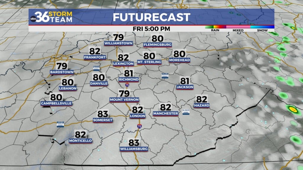
It appears we’ll squeeze in one more dry day across the area on Wednesday as the area of high pressure responsible for the good weather gives way to the east. This will allow temperatures to warm even more with afternoon highs making a run at the 90 degree mark in most spots. While humidity levels will be a bit higher, they should still be manageable Wednesday afternoon before they really start to climb into the late week.

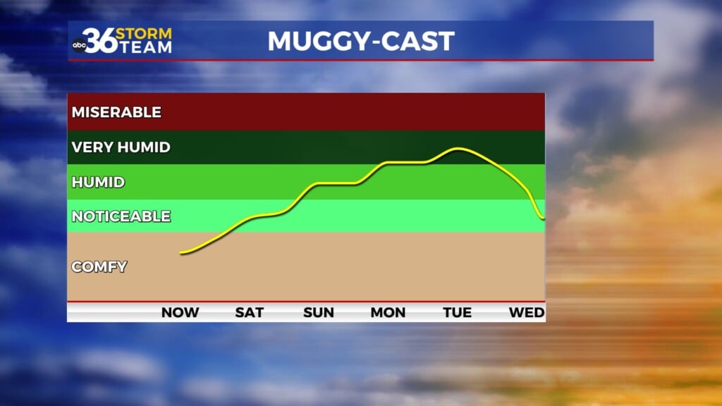
A muggy and unsettled weather pattern, which is pretty typical for mid-July will kick back in late week and continue as we head into the weekend. This pattern is always a challenge given that the timing and placement of the storms, so that can have a big impact on conditions and even temperatures so that’s something to keep in mind. No one day through the extended should be a wash-out but we’ll definitely be dodging a few showers and storms on occasion. We will be sandwiched between a bubble of hear across the Southern Plains and an upper low over Southern Canada, which puts us in the active zone as storms fire to our north and west before sliding into the heart of the commonwealth.


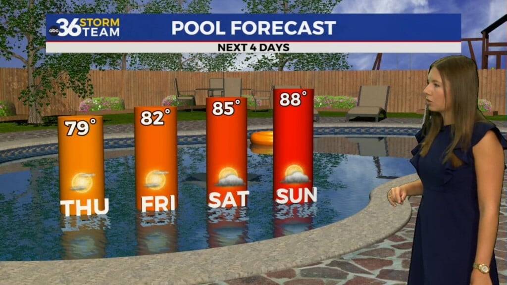
Beyond the thunderstorms the other issue will be the humid conditions that will hang tough over the area through the weekend and into early next week. Dew-point temperatures (a great measure of the amount of moisture in the atmosphere) will be much higher into the upper 60s and low 70s, which is when we really get that tropical and uncomfortable feel to the air. The muggy conditions will also add plenty of moisture to the air for showers and storms to develop, especially during the warmth of the afternoon and evening. Highs through the weekend and into early next week should mainly be into the mid to upper 80s.

ABC 36 HOUR FORECAST
TUESDAY NIGHT: Mostly clear and quiet. Lows in the mid-60s.
WEDNESDAY: More sunshine, a bit warmer. Highs in the upper-80s to around 90.
WEDNESDAY NIGHT: Breezy and warm, a few storms. Lows around 70 degrees.