Pleasant spring weather mid-week before muggy and unsettled weather returns
We'll enjoy a quick break from the humid air as high pressure brings sunshine and nice conditions Wednesday
After a warm and humid start to the week with a few rounds of showers and thunderstorms, Tuesday was much more quiet across Central and Eastern Kentucky as the frontal system responsible for the storms dropped south of the commonwealth. We were left with some low overcast through the morning along with I-64 corridor before the sun broke out while Southern Kentucky enjoyed a bit more in the way of sunshine as afternoon highs reach the mid-70s in most locations. Humidity levels started to fall as drier air worked in and that will be a prelude of things to come into the mid-week. Before exiting the area, the front did produce a few storms with large hail during the early hours across parts of the area with upwards of golf ball sized hail falling.

With high pressure in control and drifting into New England on Wednesday, expect a delightful day with sunshine, a pleasant east wind and afternoon highs into the mid to upper 70s. The east wind will keep our humidity levels down quite a bit so it will feel really comfortable! Make some outdoor plans if possible since it will feel very nice with the lack of muggy air.

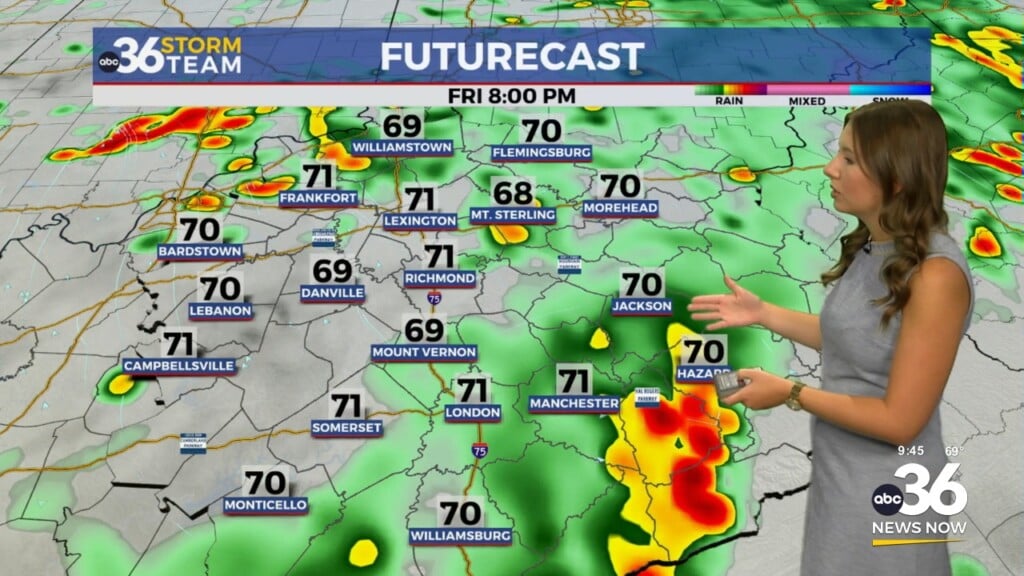
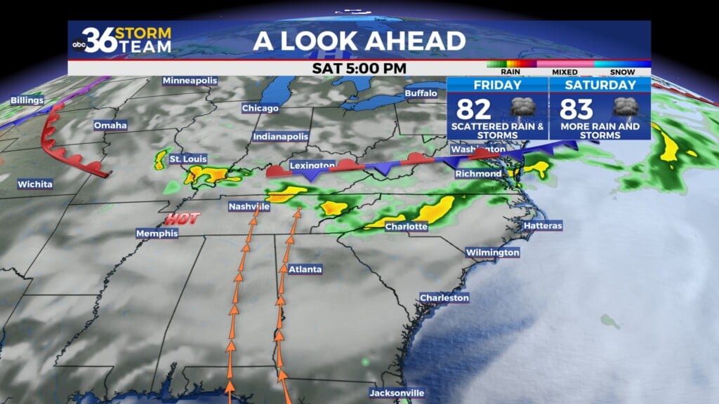
Heading into the late week we should squeeze in another dry day on Thursday as temperatures and humidity levels begin to increase a bit. Afternoon highs Thursday should reach the 80 degree mark in most locations as a southeast wind begins the return flow of moisture with high pressure to our east, thus the slight increase in the muggy air. By Friday, the warm front will be laying north of the commonwealth into the central part of the Ohio Valley, firmly putting Central and Eastern Kentucky in the warm and humid sector. This will increase our chances for scattered showers and thunderstorms to end the week Friday with highs into the low 80s despite the clouds and storms around.

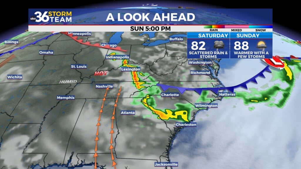
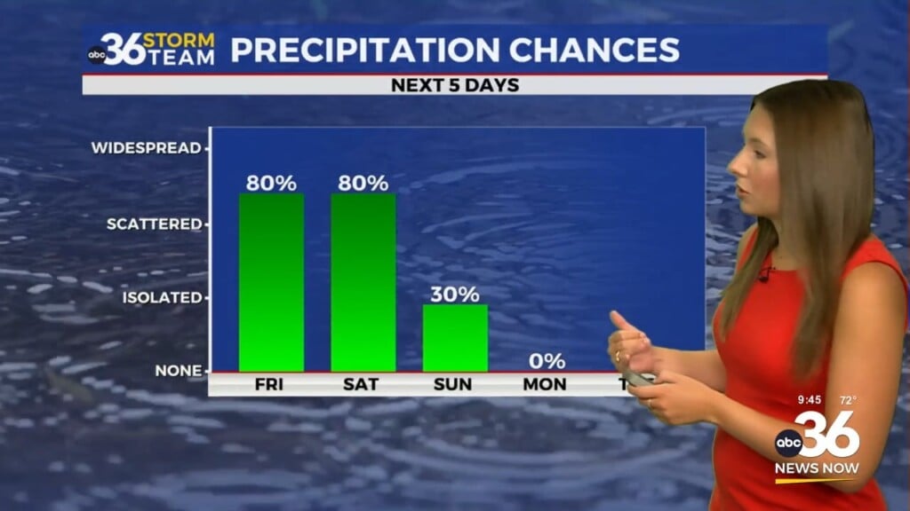
With the boundary stalled to our north and several waves of energy riding along it expect a daily chance of showers and storms through Mother’s Day weekend. While it shouldn’t be a wash out on any particular day, much of the activity will be driven by the warmth of the afternoon so the best window for the storms will be later each day. Notice how our “muggy meter” jumps up through Mother’s Day weekend. The frontal boundary will eventually sink to the south and move through late Monday with some drier air returning early next week.


ABC 36 HOUR FORECAST
TUESDAY NIGHT: Mostly clear and cooler. Lows in the upper-40s and low 50s.
WEDNESDAY: Mostly sunny and nice! Highs in the upper-70s.
WEDNESDAY NIGHT: Fair skies and pleasant. Lows in the mid-50s.