Record warmth to kick off March as more active weather looms
Another high wind event is possible Friday as a strong area of low pressure spins through the region.
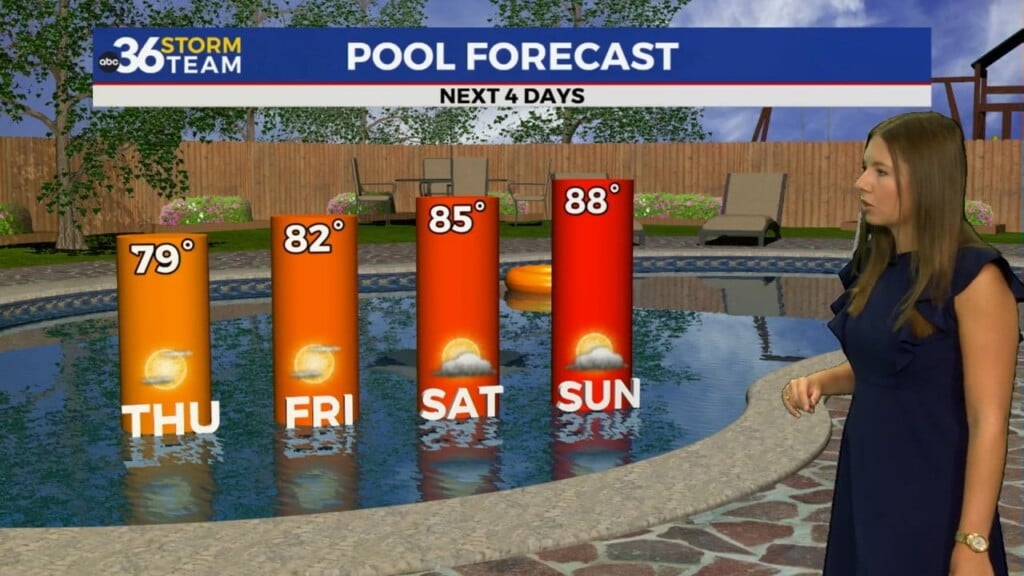
What a way to kick off the month of March across Central and Eastern Kentucky! With a warm front arcing through the region early combined with sunshine and a strong southwest wind, afternoon highs surged all the way into the upper 70s and low 80s! Of course record high temperatures were smashed in many locations across the commonwealth. So it felt more like Memorial Day instead of March 1st, this coming after we saw the warmest February on record here in Lexington (46.9 degrees average) just barely eclipsing the previous February record for warmth set back in 2018 by a tenth of a degree. It was a beautiful first morning of the month, which set the stage for a fantastic day.

With a cold front dropping through the region into the early hours of Thursday, scattered showers and storms will develop and move from northwest to southeast with Southern Kentucky seeing the best potential for some heavier rain. Things should dry out quickly into Thursday with the bulk of the day dry and cooler with scattered clouds and highs mainly in the low 60s.

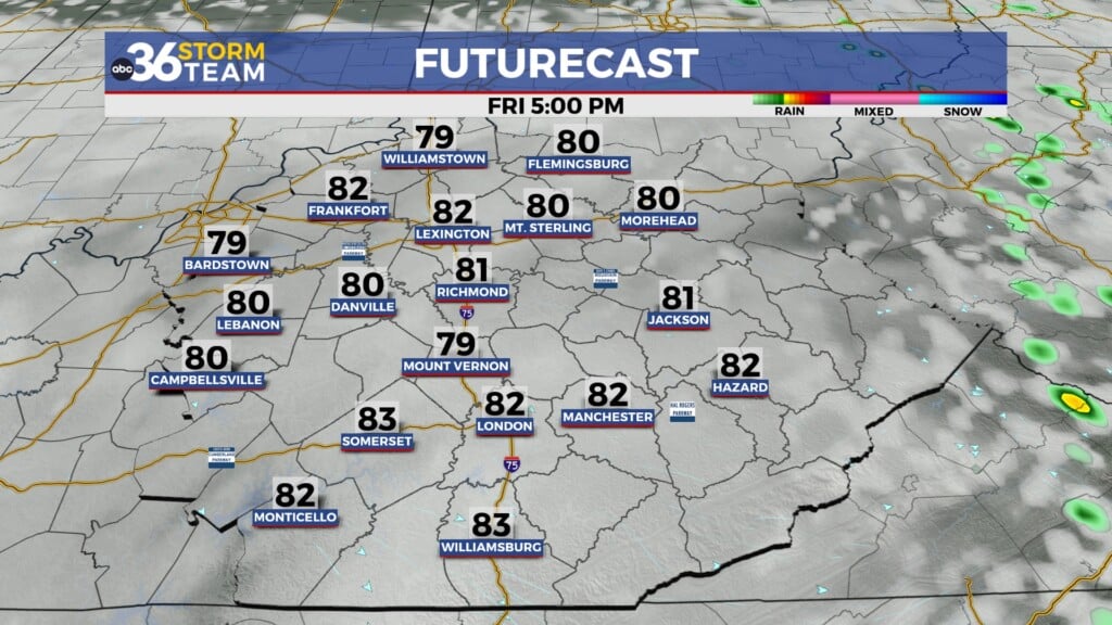
It’s been an active winter season as far as high wind events here in Central and Eastern Kentucky and the stage is set for yet another one as we close out the week on Friday. A strong area of low pressure will spin right through the heart of the Ohio Valley so winds should gusts 45 to 55 miles per hour or greater Friday afternoon, and that’s not including any strong to severe wind gusts we could see with thunderstorms that develop. For now the Storm Prediction Center has much of Central and Eastern Kentucky in a Level 2 risk (out of 5) for Friday with all modes of severe weather on the table, so you’ll want to keep an eye on the weather Friday. The good news is dry and pleasant weather is on tap for the weekend.


With this being Severe Weather Awareness Week in Kentucky, which is the time to prepare for the spring severe weather season and the fact that a few strong storms are possible on Friday, here are a few reminders about how to effectively get severe weather alerts. Stay with the ABC 36 Storm Team for the latest on our weather for the end of the week.

ABC 36 HOUR FORECAST
WEDNESDAY NIGHT: Breezy with Scattered storms, ending late. Lows in the low-50s.
THURSDAY: Scattered clouds and cooler. Highs in the low-60s.
THURSDAY NIGHT: Breezy with rain and storms returning. Lows in the low-50s.