Windy and wet weather set to return to the commonwealth
In addition to the rain, winds could gust 40-45 MPH late Tuesday and into Wednesday
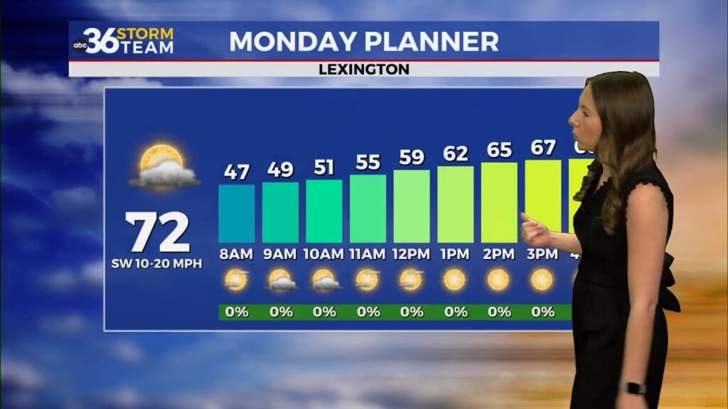
After a chilly start in the 30s, today turned out to be a fairly pleasant early March day across central and eastern Kentucky. A mix of sun and clouds allowed temperatures to climb into the upper 40s and low 50s by the afternoon making for a seasonable start to the workweek. Winds remained light, adding to the comfortable feel, but as we move forward, changes are brewing. A much warmer, windier, and more active pattern is set to take over in the coming days, bringing everything from spring-like warmth to strong winds and even some rain chances.

Warmer & Windier Tuesday
A strong southerly flow will develop tonight into Tuesday, keeping overnight lows much milder compared to recent nights. Temperatures will only drop into the mid-40s, a noticeable change from the cooler nights we’ve had lately. That southerly wind will continue to strengthen Tuesday, allowing highs to surge into the low to mid-60s by the afternoon. While much of the day looks dry, cloud cover will increase, and a few spotty showers will be possible late in the day. The bigger story will be the winds which could gust over 30 mph at times.

Strong Cold Front Brings Rain & Gusty Winds
By Tuesday night into Wednesday, a strong cold front will push through the region bringing periods of rain and potentially even stronger wind gusts, some exceeding 40 to 45 mph. While rain amounts don’t look overly significant—generally around a quarter to half an inch—blustery conditions will be the main concern. Winds will remain gusty even after the rain moves out, and by Wednesday evening, temperatures will begin falling quickly as colder air rushes in. With all the wind potential, A Wind Advisory is out for much of Central and Southern Kentucky from 4pm Tuesday afternoon until 7pm Wednesday evening.


Cooler Pattern Returns Late Week
Thursday will feel much different as highs struggle to get out of the 40s, but at least we’ll see dry conditions return. Looking toward the weekend, another system is likely to move in Friday into Saturday, bringing another round of rain. This one looks to be a bit more moisture-laden, meaning rain chances could be more widespread, though details are still coming together. Temperatures will remain seasonable, with highs generally in the 50s and lows in the 30s.

As we head into early next week, models are hinting at a shift toward a cooler pattern, with highs possibly dropping into the 40s. This could lead to a drier but chillier stretch as we move deeper into March. We’ll be watching closely to see if this trend continues, but for now, enjoy the brief taste of spring before the pattern turns more active again later this week!

ABC 36 Storm Team 3-Day Forecast
Monday Night: Clouds increase, a bit cool. Lows in the upper 30s.
Tuesday: Mostly cloudy and breezy, showers by late evening. Highs in the low-60s
Tuesday Night: Windy with rain, a few storms possible. Low in the low-50s.
Stay with the ABC 36 Storm Team for the latest updates, and have a great evening!