Unsettled weather kicks in to close out April
Rain and storm chances will be on the table the next few days
It was a mild and dry start to Tuesday across Central and Eastern Kentucky but it didn’t stay that way for long. An approaching cold front triggered scattered showers and thunderstorms by the afternoon with more expected to develop into the evening hours. While not everyone will see severe weather, some storms could pack a punch especially with damaging winds being the primary concern. The Storm Prediction Center placed much of the Commonwealth under varying levels of severe weather risk including a Level 3 (Enhanced Risk) for areas along and north of I-64 with a Level 2 (Slight Risk) across the rest of Southern and Southeastern Kentucky. The threat should gradually diminish overnight, with only isolated showers or storms lingering into early Wednesday.
Frontal Boundary Lingers, Keeping Storm Chances Alive
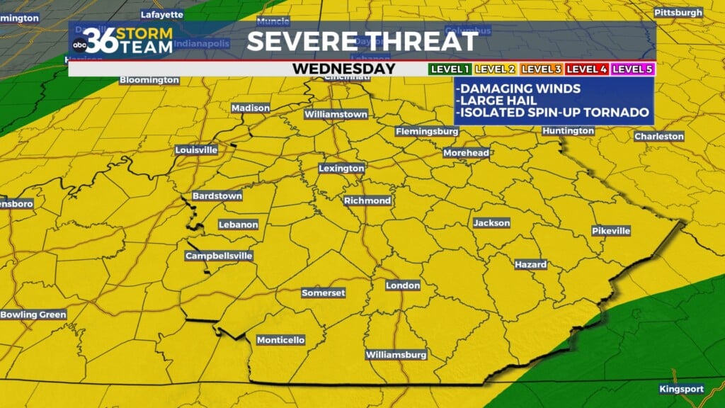
Don’t expect a clean sweep from this front just yet. It will slow down and stall over the region midweek, keeping rain and storm chances on the board for Wednesday. While widespread rain isn’t expected, scattered storms could pop up at any time with locally heavy rainfall possible. Temperatures will remain warm, topping out in the mid to upper 70s, and while the severe threat isn’t as prominent as Tuesday’s, a few stronger storms can’t be ruled out late in the day especially along the I-64 corridor as the warm front drifts northward. The SPC maintains a Level 1 (Marginal Risk) for areas mainly across Central and Northern Kentucky.
Thursday Brings Another Round of Storms to Kick Off May
A new low-pressure wave riding along the stalled front will keep things unsettled for Thursday, opening the door to more widespread showers and storms. This will mark a stormy start to the month of May, and once again, the Storm Prediction Center has placed all of Central and Eastern Kentucky under a Level 1 severe weather risk. While damaging winds remain the top concern, there’s also a low-end chance for a brief spin-up tornado. Heavy rainfall from several rounds of storms could lead to localized flooding issues, but nothing appears widespread at this time.
Eyes on Oaks and Derby Days: Improving, but Not Perfect
As we turn toward the weekend, the timing of the clearing becomes critical—especially for Churchill Downs. Oaks Day (Friday) still looks unsettled with more scattered showers and storms, so if you’re heading to the track, keep the rain gear handy. Fortunately, it appears the energy may begin pulling away by Derby Day (Saturday), although some models suggest a few clouds and even a stray shower could linger across Central and Eastern Kentucky. Areas farther west, including Louisville, are more likely to stay dry. Expect a cooler Derby Day with highs only in the mid-60s. After that, a return to sunshine and warmer weather should carry us through Sunday and into next week.
Tuesday Night: Mild with scattered storms, some strong early. Lows in the low-60s. Wind: SW 10-15 mph.
Wednesday: Partly cloudy and warm, more storms possible. Highs in the upper-70s. Wind: S 5-10 mph.
Wednesday Night: Isolated storms, still mild. Lows in the mid-60s. Wind: S 5-10 mph.


