Unseasonably mild temperatures hang tough into the late week
We'll still have to dodge some rain and storms as highs reach the 70s!
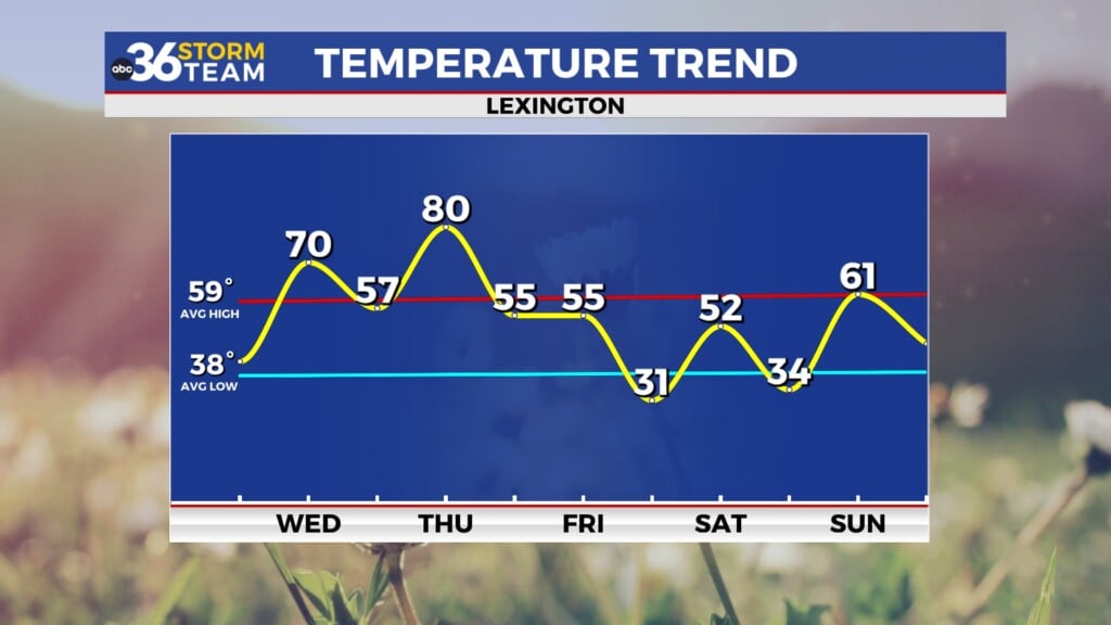
With a stalled out frontal system laying just north of the commonwealth it was another mostly cloudy and unseasonably mild day across Central and Eastern Kentucky, especially for early March. We did see a few scattered showers and rumbles of thunder during the morning hours as some weak energy moved along the boundary as it dropped a little farther to the south. Once again much of the afternoon stayed dry with highs climbing into the upper 60s and low 70s across the northern half of the state with areas down south seeing mi-70s due to the mainly dry conditions. Another wave of energy riding along the front should fire a few more showers and storms from the Bluegrass Region northward into Wednesday night with some gusty winds and hail possible with any stronger storm that develops.

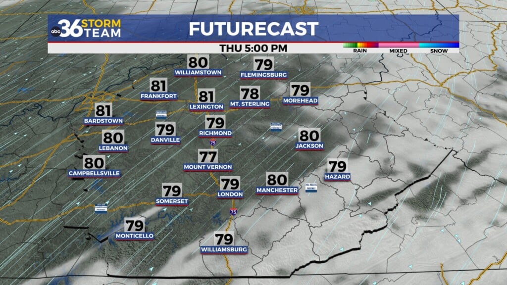
A more significant wave of low pressure should drag the front much closer to Central and Eastern Kentucky into Thursday, increasing our chances for rain and storms around the area. Fortunately these look to be garden variety storms so at this point we aren’t looking at any organized strong to severe storms. Just take the rain gear along as you head out since it will come in handy from time to time. Afternoon highs will continue to be well above average for this time of the year with temperatures topping out in the low 70s in Central Kentucky with more mid to even a few upper 70s down south thanks to a breezy southwest wind.


We’ll definitely feel like the heart of the spring season on Friday as the frontal boundary arcs back to the north as a warm front keeping the commonwealth firmly in the very mild air mass. In fact with a mainly dry day on top, a better chance of seeing some sunshine and a steady southwest breeze, afternoon highs should surge all the way into upper 70s and even approach 80 degrees in some locations. Lexington’s record high temperature for Friday is 77 degrees set back in 1973 and that may be in jeopardy. Another wave of low pressure and legitimate cold front will arrive as we head into Saturday so it looks wet and somewhat stormy again. The dynamics don’t look overly favorable for any organized severe weather but it bears watching in the coming days. Afternoon highs should still be very spring-like into the low 70s.


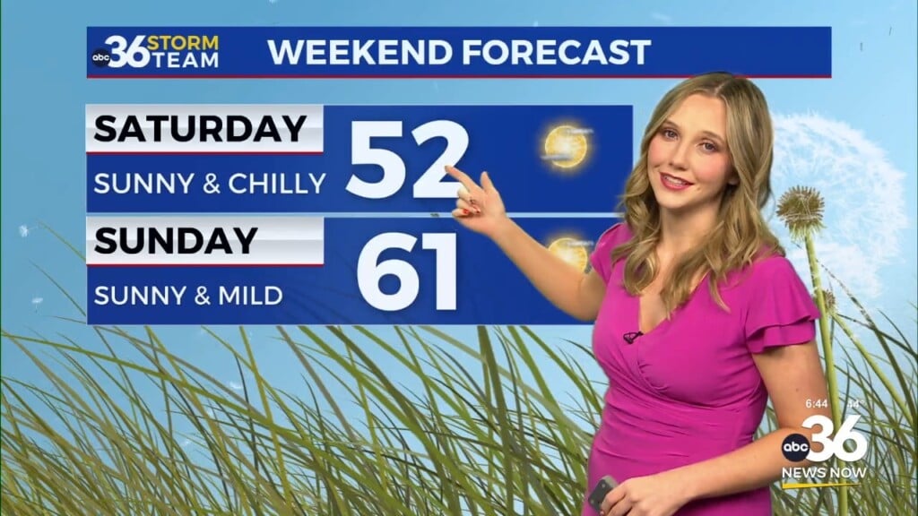
Once the front moves eastward our rain chances should back off a bit heading into the second half of the weekend and early next week. While several spots may remain dry, a few isolated to scattered showers can’t be ruled out. Temperatures will back off a few degrees with afternoon highs in the low to mid-60s, which is still above average for this time of the year. It should be a quieter period overall into early next week with a few low end shower chances and temperatures climbing back into the 70s Monday and Tuesday before yet another storm system brings additional organized rain and storm chances back to the Ohio Valley.


ABC 36 Storm Team 3 Day Forecast
Wednesday night: A few storms, mainly north. Lows in the upper-50s. Wind: S 5-10 mph.
Thursday: Breezy and mild with scattered showers and storms. Highs in the low and mid-70s. Wind: SW 10-15 mph.
Thursday night: More showers and storms. Lows in the upper-50s. Wind: SW 5-10 mph.