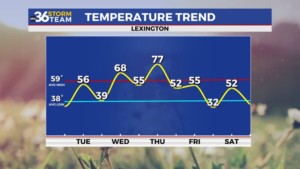
Typical mid-July warmth late week before the heat returns
After a breezy and cooler Wednesday, temperatures will start the climb back into the 90s over the next few days
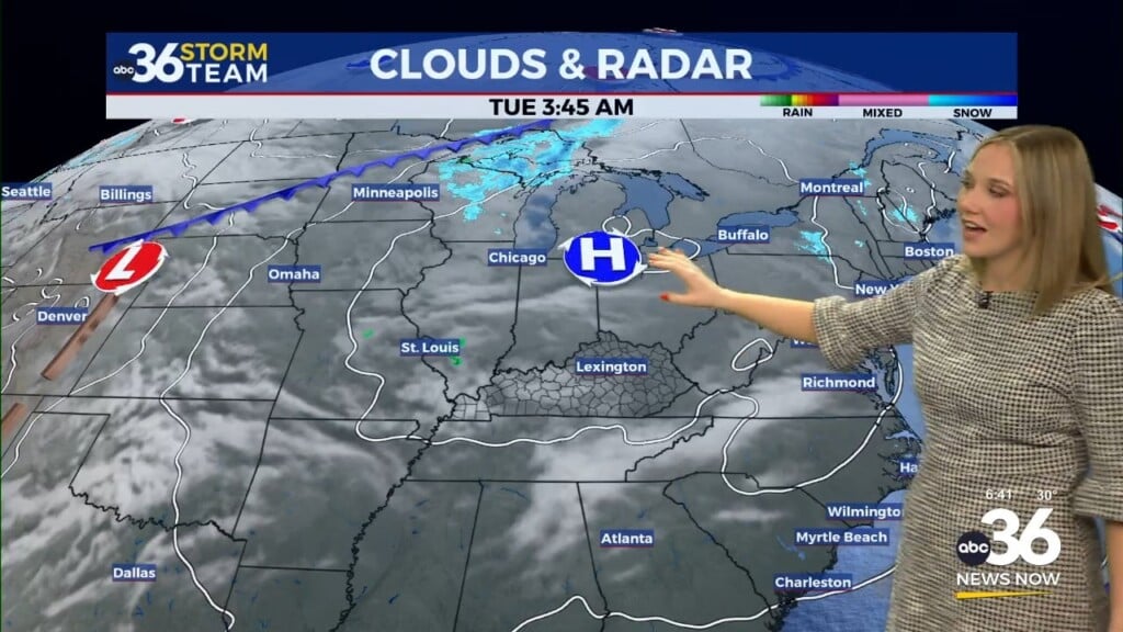
After dodging the severe weather potential across much of Central and Eastern Kentucky on Tuesday (in addition to getting very little rain period), it was quite a different story weather-wise on Wednesday being on the backside of the remnant low from Beryl. The heat and humidity from Tuesday was replaced by clouds, unusually strong winds for July and unseasonably cooler temperatures. Most locations saw afternoon highs a solid 15 degrees cooler on Wednesday with most locations only topping out in the upper 70s thanks to the clouds and wind while a few spots manage to sneak into the low 80s with some late afternoon sunshine returning.

Heading into the late week the remnants of Beryl will finally clear the eastern part of the country allowing for drying conditions in most locations. The only issue is that some weak energy should get caught in the upper level flow streaming across the Central Ohio Valley . While most locations are looking at mostly sunny and warm temperatures, a few showers should develop just to our northwest and some of those could drift into areas west of Lexington late in the day but those should be isolated at best. Afternoon should be right around average for mid-July with readings topping out into the mid to upper 80s.


Rolling into the upcoming weekend additional heat will be poised to push eastward into the Ohio Valley so above average temperatures are expected as highs climb into the mid-90s beginning Saturday. Our in-house data may be a little aggressive with the isolated storm chances on Saturday but we could see a could pop up more so into Sunday and beyond. With humidity levels elevated and temperatures expected to be pretty hot, our heat index values could rise to 100+ degrees in a few locations so you’ll want to be extra careful for any outdoor activities that you may have planned this weekend. Staying hydrated is key along with cooling off every once and awhile.


The lack of widespread rain of late and the hot weather combined has put our area squared in the crosshairs of another summer drought. The long range temperature outlook keeps afternoon highs above average through next week, which would keep us mostly in the 90s for highs. Couple that with the lack of any significant rain (check the 30 day deficit map below) and we may see parts of the region in a moderate drought once the drought monitor is updated for this week on Thursday afternoon.


ABC 36 HOUR FORECAST
WEDNESDAY NIGHT: Clearing out and pleasant. Lows in the low-60s.
THURSDAY: Mostly sunny and warm, a stray shower west late. Highs in the mid to upper-80s.
THURSDAY NIGHT: Mostly clear and quiet. Lows in the mid-60s.