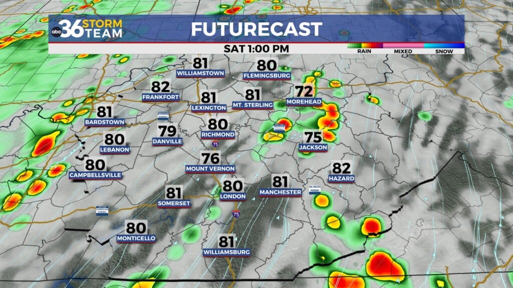
Typical July pattern with daily storm chances
No day will be a wash-out but we'll take whatever rain we can get given the overall dry conditions
It was a mainly cloudy start to the week across Central and Eastern Kentucky thanks to an early morning cluster of thunderstorms leaving a bit of cloudiness in its wake. A stalled out frontal boundary just south of the commonwealth helped to produce a few isolated storms along the state line with Tennessee through the afternoon but most locations ended up being dry through the day. One positive to the cloud cover is that it held temperatures in check with most locations struggling to reach the upper 70s to low 80s, a good 8 to 10 degrees below average for this time in July.
We are set-up for a “rinse and repeat” scenario the next few days as the aforementioned boundary remains stalled out to our south. The overnight hours should be mainly dry other than a stray storm with temperatures early Tuesday morning in the upper 60s. Once thing start to warm up into the afternoon with all the moisture around, a few scattered storms will be possible. Any of these have the potential to produce some localized heavy rainfall given the slow movement of anything that pops up. Afternoon highs should reach the low to mid-80s but could be held down again if more cloud cover wins out.
There is a slight change in the overall pattern expect later this week as a cold front drops in from the northwest into Thursday. This front should provide enough lift to produce more organized rain and storms so it appears that will be our best window for any “widespread” rain and storms through through the period. Even though it isn’t going to be overly muggy the next few days, we should see a slight dip in the “muggy-cast” as we head into the late week.
The big question heading into the weekend is how far south this frontal boundary will move before putting on the brakes. Right now the model data isn’t synced up with the overall outcome with some moving it through the commonwealth, which would mean a mainly dry and warm weekend ahead while the other scenario has the front slowing down over our area and stalling out, which would mean more rain chances are generally unsettled weather this weekend. For now we’ll keep isolated storm chances in this weekend with temperatures warming back into the upper 80s but it definitely bears watching.
ABC 36 HOUR FORECAST
MONDAY NIGHT: Warm with stray storms. Lows in the upper-60s.
TUESDAY: Mostly cloudy, a few P.M. storms. Highs in the mid-80s.
TUESDAY NIGHT: Still warm and muggy, isolated storms possible. Lows in the upper-60s.


