Temperatures are on the rise as rain gets set to move in on Friday
Meteorologist Jordan Smith has a look at your Tuesday evening forecast!
Lexington, Kentucky: Good Tuesday evening everyone, temperatures today got above freezing for the first time since Thursday evening. That is 108 consecutive hours that Lexington was below freezing. The last time that happened was February 2021, almost a year ago. Lows by morning hit the low to mid 20’s but we see a quick increase in temperatures by the afternoon with mid to upper 40s across central and eastern Kentucky. We have another completely dry day on Thursday as highs jump even more into the low to mid 50s across the Commonwealth.
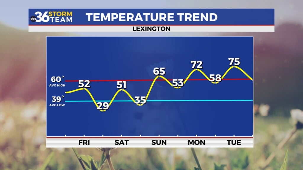
Friday starts dry but will bring an increase in rain during the second part of the day. Areas to our west may see the rain as early as Friday morning, but it’ll overspread the rest of Kentucky into the afternoon. More on the rain in just a minute, first lets just acknowledge the increase in temperatures. Temperatures remain in the mid upper 50s into New Years Weekend, but low 60s looks possible for the first few days of 2023. You can see that on the temperature outlook below that we will be above average. The above average temperatures will be for most of the eastern half of the country. A total pattern flip from the last several days.
Now unfortunately we have to get back to the rain because with our warmer temperatures comes an increase in rain. Rounds of rain will be likely from Friday afternoon – Sunday afternoon. This time frame is not a washout, but you will want to have the rain hear handy as you head to any New Years Eve/Day plans/ After a small break Sunday afternoon – Monday, more rain moves back in for Tuesday/Wednesday of next week.
We could be talking about some decent rain totals. I even think there is the possibility of local high water issues Saturday if one location gets in on repeat rounds of rain. The models paint a general 1″-3″ of rain through next Tuesday but locally higher amounts are certainly possible. If I was to expand the rainfall numbers out through next Wednesday I think they would increase by another inch or two.
TUESDAY NIGHT: Clearing skies begin to take over. Temperatures into the low to mid 20s.
WEDNESDAY: Temperatures increase as skies clear with high temperatures in the mid 40s.
WEDNESDAY NIGHT: Main clear with temperatures in the mid to upper 30s.


