Sunshine at a premium with more rain on the way!
Much of the area was socked in with cloud cover Thursday as our next storm moves in for the end of the week
As expected the low level moisture and cloud cover hung tough on Thursday across Central and Eastern Kentucky making for another dreary day. Pulling out the positive at least it was dry and a few spots across the southern and southeast part of the state did manage to squeeze in a few peeks of sunshine. Speaking of, sunshine has been at a premium the last few days and unfortunately we probably won’t see much over the next few days. Even with the clouds around, afternoon highs were in the mid to upper 50s Thursday in most spots, which is just about where we should be here in early March. Many trees and plants are getting a jump start on spring given all the mild weather the last few weeks.

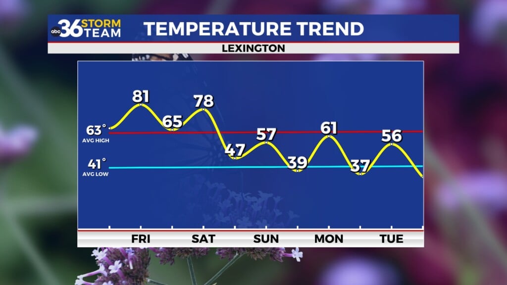
Our next storm system will arrive as we head into Friday with the first of 2 waves of low pressure set to track through the Ohio Valley. With breezy winds out of the south pushing moisture and milder air into the region afternoon highs should make a run back into the low 60s. The activity should be scattered on Friday and it doesn’t appear to be a steady rain all day but there is the potential for a few moderate to heavy downpours at times with any activity that develops.


The second wave will follow suit Friday night and into Saturday bringing a better chance for more widespread rain along with a few rumbles of thunder. The exact track of the low will be critical to where the heaviest rain falls through the event and right now it appears the low will spin right through the heart of the commonwealth. It should be breezy once again on Saturday with our daily highs coming early afternoon into the upper 50s and low 60s before the front slides eastward. Keep in mind that if the low tracks a bit farther to our west, we could see a strong storm or two but that’s still to be determined. We are looking at some solid rainfall totals with a 1″ to 1.5″ totals a possibility. Given all the wet weather of late, we could see a few minor flooding issues in the low lying areas.


We should dry out and cool down to end the weekend on Sunday with afternoon highs only in the upper 40s. Expect a few cold mornings as well. The good news is that our weather looks dry and much warmer heading into next week as we see a tranquil, spring-like pattern kick in for a few days. Afternoon highs will recover through the 50s and we into the 60s on Tuesday and Wednesday before making a run at the 70 degree mark on Thursday.

Just a reminder that Daylight Saving Time returns at 2am Sunday morning so it is time to “Spring Forward”! Clocks need to be set forward 1 hour Saturday night before bed (many of them change automatically now) and it is a good time to check the batteries in your smoke detectors and change them if needed. Sure we’ll get 1 less hour of sleep Saturday night but it will stay lighter alter in the evening beginning on Sunday.


ABC 36 HOUR FORECAST
THURSDAY NIGHT: Mostly cloudy and cool. Lows in the upper-40s.
FRIDAY: Breezy with scattered rain. Highs in the low 60s.
FRIDAY NIGHT: Breezy with more rain. Lows in the low-50s.


