Strong to severe storm chances on tap again for Tuesday
All severe weather modes are possible including a few tornadoes
After a much-needed stretch of dry, sunny weather over the weekend, Central and Eastern Kentucky finally had a chance to catch its breath. That break was especially important for Pulaski and Laurel Counties, where recovery and clean-up are underway following the destructive, deadly long-track tornado that tore through the area late Friday into early Saturday. Monday started on a calm note, but clouds thickened and a few scattered storms popped up to the west by the afternoon, signaling a more active setup on the way.
Another ABC 36 Weather Impact Day Tuesday
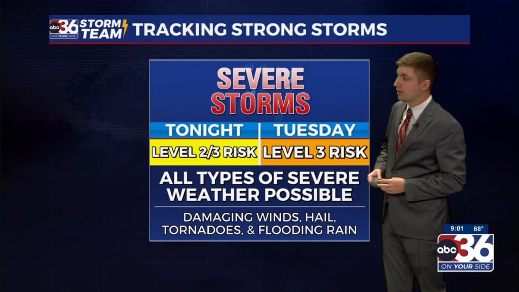
Unfortunately, the quiet conditions won’t last. Tuesday is shaping up to be another ABC 36 Storm Team Weather Impact Day as our next system arrives. A strong low pressure system and cold front will swing in from the west, bringing the risk for strong to severe storms, especially by the afternoon and evening. All types of severe weather are possible, including damaging winds, large hail, and even an isolated tornado.
There is some uncertainty around how Tuesday unfolds. A complex of storms may drift in from the west early in the day. If it sticks around long enough, it could limit instability, and that could hold back the severity of afternoon storms. But if things clear out quickly, the atmosphere will reload fast, and a few isolated supercells could develop before transitioning into a squall line later in the day. That line may bring damaging winds and a few spin-up tornadoes, a setup that’s more typical for our area compared to last Friday’s long-track tornado event.
The Storm Prediction Center has much of Southern Kentucky in a Level 3 out of 5 severe risk, with an elevated tornado risk there and points to the west and southwest. Farther north, Central Kentucky is in a Level 2 out of 5 severe risk so you’ll need to stay weather aware all day! In addition to the severe weather, heavy rainfall could lead to localized flash flooding, particularly in areas that see multiple rounds of storms so a Flood Watch is out for Eastern Kentucky until 2am Eastern time on Wednesday.
Cooler, Showery Days Ahead Mid-to-Late Week
Once Tuesday’s front passes through, a shift in the pattern takes hold. An upper-level low over the Northeast will set up a persistent northwest flow, keeping us unseasonably cool through Thursday and possibly into the weekend. Look for scattered showers Wednesday and Thursday as small disturbances rotate through the cooler air. Afternoon highs will struggle to get out of the 60s, running more than 10 degrees below average for this time of year.
The good news? Friday is trending drier, and it looks like we’ll kick off the Memorial Day weekend on a quieter note—just still on the cool side, with highs only in the mid-60s. Temperatures may moderate slightly by Memorial Day itself, but with increasing chances for rain, it’s something we’ll be watching closely.
Monday Night: Mostly cloudy with storms late. Lows in the upper-50s and low-60s. Wind: E 5-10 mph.
Tuesday: Occasional rain and storms, some strong to severe. Highs in the upper-70s. Wind: SE 10-15 mph.
Tuesday Night: More rain and storms. Lows in the low-60s. Wind: SW 10-15 mph.


