Rain finally returns to Central and Eastern Kentucky
It had been more than 2 week since any decent amount of rainfall before Wednesday and more is on the way into the late week
It was just what the doctor ordered across Central and Eastern Kentucky on Wednesday…and that was RAIN! The last time we’d had any real measurable rain around the area was back on September 12th and before that it was just over a month ago on August 25th. While the rain and storms were scattered about, the favored areas were Northern Kentucky late Tuesday evening with Southern Kentucky being the sweet spot Wednesday. It was almost too much of a good thing in a few locations with some spots seeing a 2″-3′ rainfall down south, which caused some minor low lying flooding issues but nothing major fortunately.

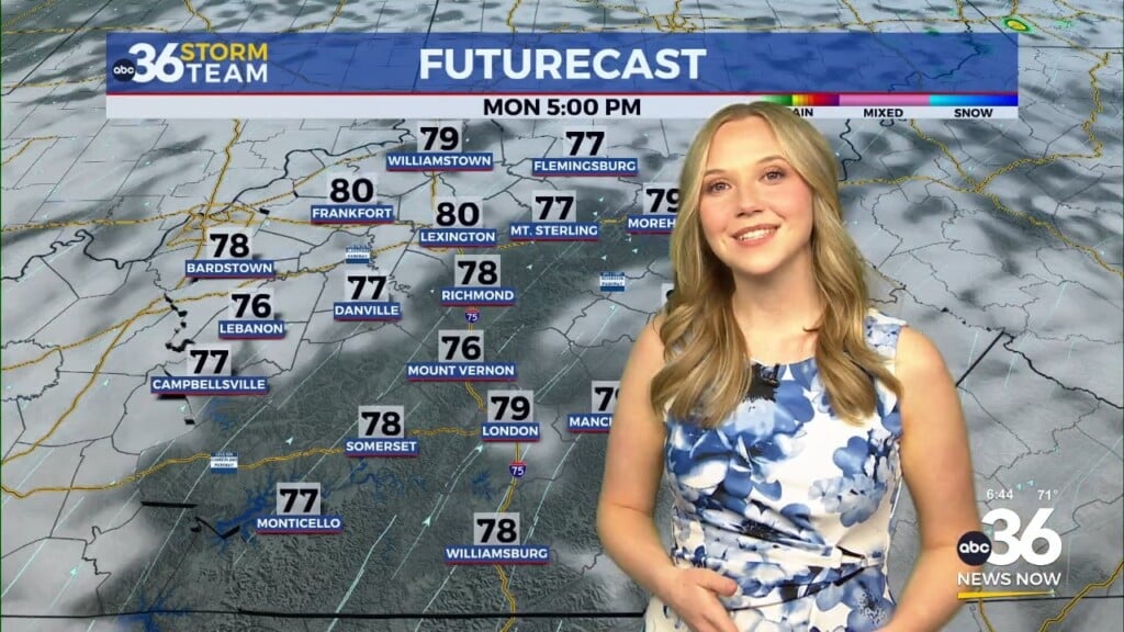
The chances for heavy rain will stay with us into the early hours of Thursday before the activity becomes a bit lighter and more scattered during the daylight hours. In this scenario, we could see some additional localized and minor flooding issues as the same areas continue to receive some heavier rainfall. Of course on the plus side this rain will go a long way to help reducing our rain deficit and get some much needed water in the ground. Some of the data is showing a widespread 1″ to 2″ rain by the time it’s all said and done late Thursday. Of course temperatures will be held in check Thursday with highs struggling into the low to mid-70s.


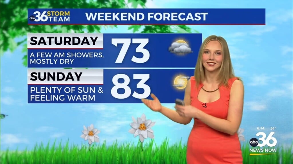
Once the area of low pressure responsible for all the wet weather weakens out to our east, we will quickly head back into a quiet, dry and warm weather pattern heading into the weekend and through the first week of October. It should be ideal weekend for any outdoor activities across the area and the timing couldn’t be better with all the fall festivals in high gear in addition to the huge game between Kentucky and Florida out at Kroger Field Saturday at Noon. Afternoon highs should sneak into the low 80s so it should be a nice afternoon but you’ll need the sunscreen as high pressure drops in from the northeast, keeping conditions comfortable all weekend.

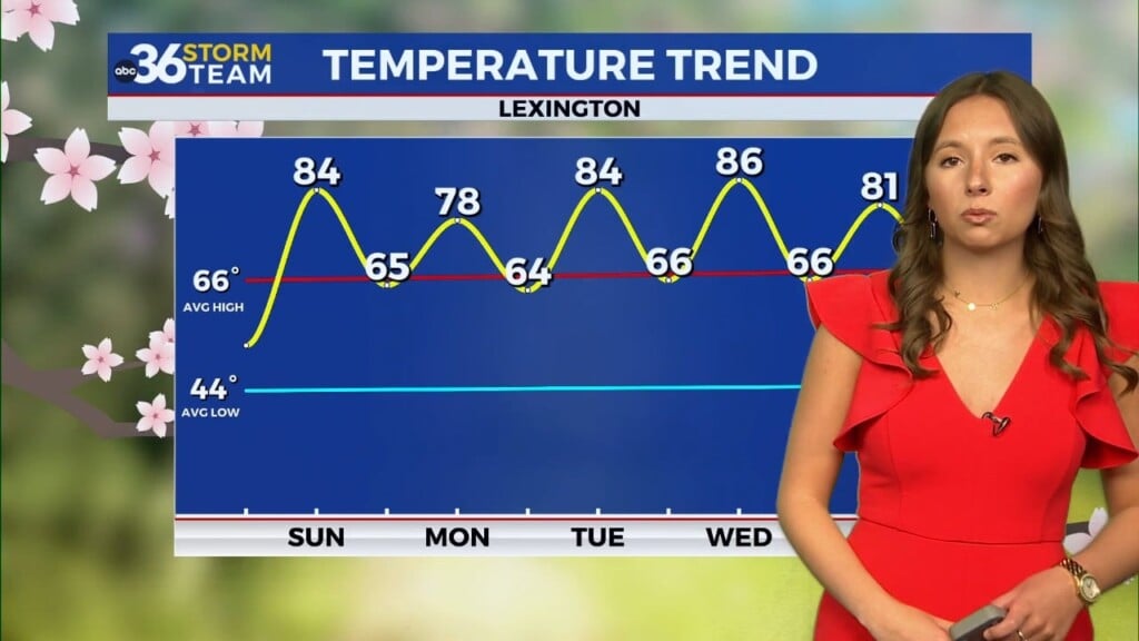
Kicking off October, our weather looks dry and unseasonably warm for the first several days of the new month. With the large area of high pressure dominating the eastern part of the country, we are in for another extended stretch of quiet weather which is pretty typical during the early fall season here in the commonwealth. Much of the long term data shows below average rainfall totals and above average temperatures. We could possibly see afternoon highs climb into the mid to upper 80s, a good 10 degrees plus above where we should be in early October so stay tuned.


ABC 36 HOUR FORECAST
WEDNESDAY NIGHT: Scattered rain and storms. Lows in the low-60s.
THURSDAY: More showers, some thunder. Highs in the mid-70s.
THURSDAY NIGHT: Showers ending, patchy fog. Lows in the upper 50s to low-60s.