Rain chances ramp up heading through the weekend
Our great stretch of early February weather will come to an end with several rounds of showers over the next few days.
It’s been an amazing run of dry days and unseasonably mild temperatures across Central and Eastern Kentucky here in early February but an unusual weather pattern like this won’t last forever so we have some changes on the way. Friday ended up being fairly decent despite mainly overcast skies but more importantly it was dry other than a spotty shower in our southern counties. Temperatures continued to stay well above average with highs in the upper 50s and low 60s despite the overcast conditions and we even managed to squeeze a little sunshine in spots right around daybreak on Friday.

Heading into early Saturday the first of several waves of energy will roll through our region setting the stage for occasional rain and even some thunderstorms around. Temperatures won’t move very much into Saturday morning with readings in the mid-50s. As a frontal boundary moves in the dynamics will be in place for thunderstorms and a few of them could possibly be strong but the best chance of that will be out into Western Kentucky. The Storm Prediction Center does have a low end severe risk for areas around Frankfort westward so just something to keep in mind.


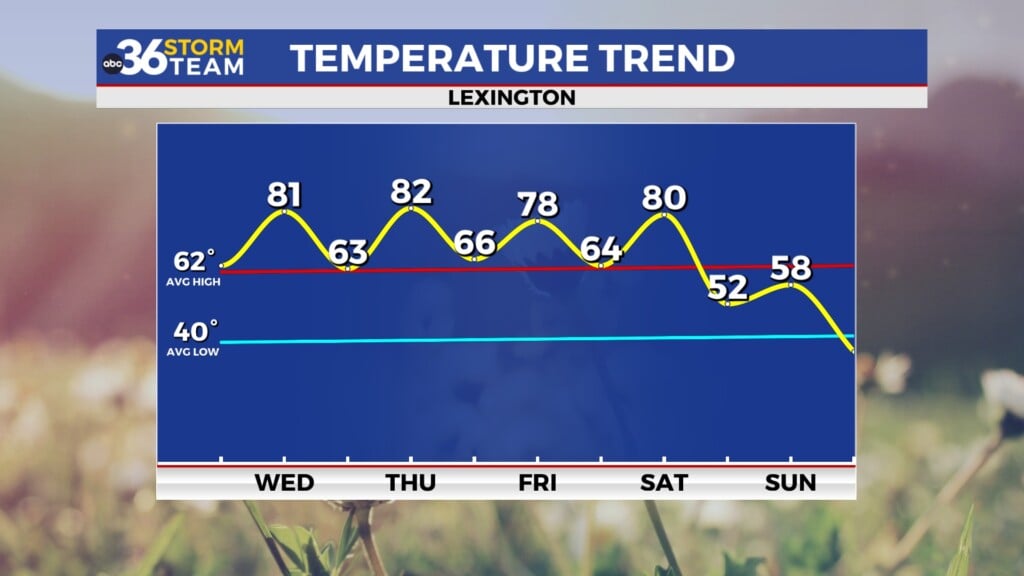
By the afternoon hours Saturday conditions should improve with the rain temporarily ending and clouds hanging tough for the rest of the day. Winds will be breezy out of the west and there shouldn’t be a big push of cooler air so we’ll squeeze in one more day of unseasonably mild air before that finally comes to an end. Highs should reach the low 60s in most spots with round 2 of the weekend rain arriving into Saturday night and early Sunday. It looks like the favored area for the highest rainfall totals into Sunday morning will be Southern and Southeastern Kentucky where upwards of 1″ rain totals can be expected.


It does like dry for the daylight hours on Sunday with mostly cloudy skies remaining as we’ll be in between systems. The biggest chance will be the slow shift to lightly cooler air as winds shift to the northeast. Under the clouds afternoon highs should reach the low 50s, which is still above average for early to mid-February.

The 3rd and final wave will slide in from the southwest into Monday bringing a more widespread chance of rainfall across the area. With clouds and rain around, expected a coolish day with highs into the upper 40s. As this system departs to the east, some wrap around moisture and colder air could prompt a few snow showers into the early hours of Tuesday as temperatures head toward freezing. Any flakes and leftover showers should be gone by late morning with afternoon highs rebounding into the low 40s, just a bit below average as we close in on Valentine’s Day.

ABC 36 HOUR FORECAST
FRIDAY NIGHT: Breezy with scattered showers and storms. Lows in the mid-50s.
SATURDAY: A.M. storms then mostly cloudy. Highs in the low 60s.
SATURDAY NIGHT: Cooler with scattered rain returning. Lows in the low-40s.


