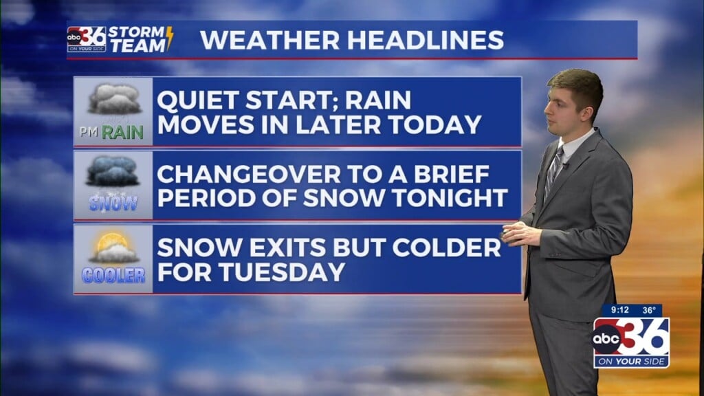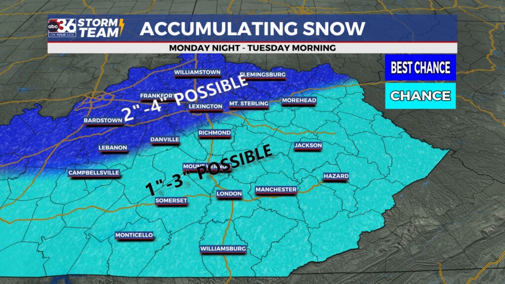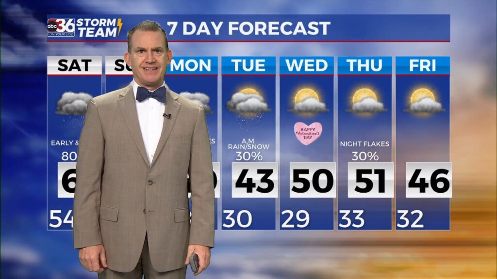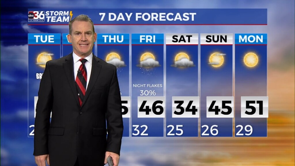
Fast moving system could bring a quick shot of snow into early Tuesday
Most locations should see light accumulations of wet snow with locally higher amounts where the heaviest bands set up
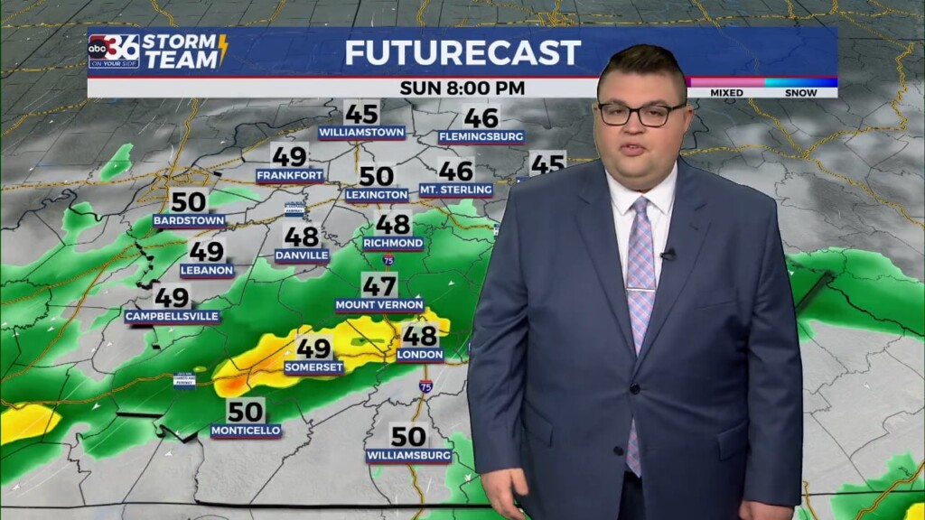
It was a fairly quiet start to the week Monday weather-wise across Central and Eastern Kentucky with mainly overcast conditions, some patchy fog in the south and afternoon highs a bit above average in the upper 40s and low 50s. As a fast moving area of low pressure slides in from the southwest, we are looking at some impactful weather…