Pleasant spring weather continues into Tuesday
A big warm-up may finally be on the way by the weekend
After a nice Mother’s Day weekend where most locations ended up dry from start to finish, we enjoyed a pleasant beginning to the new week across Central and Eastern Kentucky Monday. With high pressure building into the Great Lakes, a few spotty showers during the pre-dawn hours gave way to plenty of sunshine throughout the day. Even with a light northeast breeze in place, temperatures managed to climb back close to average with afternoon highs reaching the low-70s in most locations.

The quiet weather pattern should stick around rolling into Tuesday as high pressure drifts off to the east. This will allow more of a southwest flow which will push slightly milder air back into the commonwealth. With lots of sunshine in place it should be another fantastic mid-May day as afternoon highs climb back into the mid-70s.

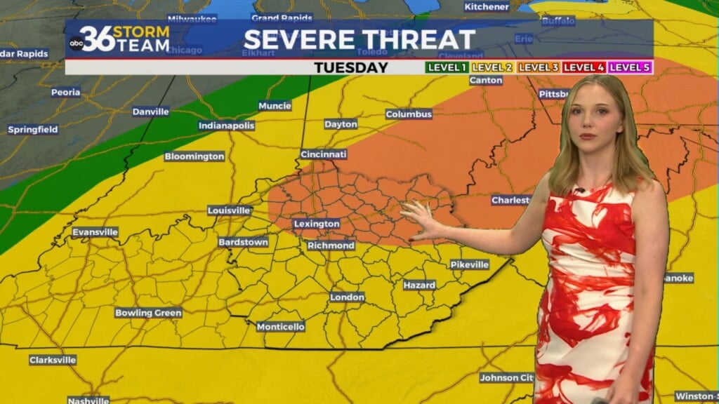
A weak frontal system will drop through the area into the mid-week bringing the potential for scattered showers and storms will be on the increase into Wednesday. Unfortunately it doesn’t appear there is a lot of moisture with this system so the activity should be fairly scattered and won’t do much to put a dent in the on-going spring drought that we are currently dealing with. Beyond the shower chances, it should be a breezy and mild day with afternoon highs in the mid-70s. Once the front slides through, slightly cooler air drier air will return for Thursday with more sunshine back in the picture and afternoon highs in the upper 60s, which is a little below average for this time of the year.


The big story heading toward the weekend will be the return of summer-like warmth across the eastern part of the country after an unseasonably cool first half of May. We’ll close out the week Friday with a really nice day as sunshine sticks around and afternoon highs climb back into the mid-70s. As an upper level ridge of warmer air builds eastward this weekend, temperatures should surge back into the mid and possibly even upper 80s so we’ll jump head first back into a summer-like feel. The timing is great for any outdoor plans you may have, however a few weak waves of energy will slide through the Ohio Valley so look for scattered storms to pop up on occasion, especially during the heating of the day. The warmer pattern looks to continue into early next week with highs well above average for this time of the year.


ABC 36 Storm Team 3 Day Forecast
Monday night: Mostly clear and cool. Lows in the mid to upper-50s. Wind: NE 5 mph.
Tuesday: Mostly sunny and pleasant. Highs in the mid-70s. Wind: SW 5-10 mph.
Tuesday night: Partly cloudy and breezy, a few showers late. Lows in the mid to upper-50s. Wind: SW 10-15 mph.