One more unseasonably warm day before our rain chances ramp up
Afternoon highs should jump into the mid-70s Thursday before a cold front arrives to end the week.
It was another fantastic day of weather across Central and Eastern Kentucky on Wednesday as a ridge of high pressure over the eastern part of the country kept the entire region unseasonably warm. The weak upper level system stayed to the north so the threat for isolated shower went away, allowing for more sunshine and a southwest wind to push afternoon highs all the way into the low 70s across the board. These readings are a solid 15 degrees plus above average for early March so hopefully you’ve had a chance to enjoy this spring-like stretch so far this week.

We should squeeze in one more day of well above average temperatures along with hopefully a mainly dry day as a warm front arcs through the area. There is the potential of a few isolated storms popping up during the warmth of the afternoon but it appears the favored spot for that will be areas just to our north and west. The big story again will be the warm temperatures as afternoon highs surge all the way into the mid-70s, which is around 20 degrees above average for this time of the year. So basically it will feel more like an average day in mid-May than it will mid-March.


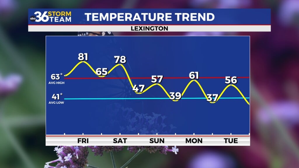
A cold front will make a run for the Ohio Valley Thursday night and into Friday increasing our chances for rain and storms. While a few strong storms can’t be ruled out, the more favorable area is again just to our west into Friday morning but it is something to keep an eye on. The rain could be heavy at times with the majority of it falling during the first half of Friday ahead of the front. Temperatures will start out very mild around 60 degrees Friday morning with the cold front arriving in the Bluegrass region by early afternoon. This will only allow temperatures to recover into the mid-60s before they drop off a bit late day. Once again some healthy rainfall totals will be possible with this system with 1″ of rain potentially in several locations.


There is good news for the weekend as much of the data is now indicating that we’ll see more sunshine Saturday instead of the clouds lingering. With no real push of colder air behind Friday’s front we should see afternoon highs in the low 60s so that’s a bonus. The southern wave of energy we’ve been tracking the last few days for St. Patrick’s Day looks weaker and father south so we should be rain-free with just a few clouds and highs in the upper 50s.

It should still feel like the winter season as it officially comes to an end early next week as a legitimate cold front slides through the Ohio Valley on Sunday night. With some lingering moisture in the colder air on Monday we could see a few snowflakes mixed in with passing showers as afternoon highs only reach the low 40s to begin the week. Spring officially arrives at 11:06 pm Tuesday evening and it will start to feel more like it by the middle of next week as temperatures recover into the 50s.

ABC 36 HOUR FORECAST
WEDNESDAY NIGHT: A few clouds and pleasant. Lows in the low-50s.
THURSDAY: Mostly sunny, breezy and warm…isolated P.M. storms. Highs in the mid-70s.
THURSDAY NIGHT: Breezy and mild with rain and storms. Lows in the upper-50s to around 60 degrees.


