Much needed rain chances pick up through the week
Widespread showers look possible into Thursday
After a nearly perfect long Labor Day weekend across Central and Eastern Kentucky with sunshine, afternoon highs in the low to mid-80s and just a few isolated pop-up storms down south on the holiday, it was a warm Tuesday as folks headed back to work and school. With a mix of clouds and sunshine, afternoon highs reached the low 80s as a weak wave of energy dropped through the Ohio Valley. This helped trigger a few scattered storms storms during the warmth of the afternoon that produced some locally heavy downpours and gusty winds. Fortunately our trend of rain chances will ramp up later in the week, which is great news given how dry it’s been the last month or so.
Wednesday looks like another nice early September day as the wave of energy begins to pull east of the commonwealth. While humidity levels will be higher than they have been lately, they should remain fairly comfortable for this time of the year. Afternoon highs should remain in the low to mid-80s with just a low-end showers/storm chance mainly for areas east of I-75.
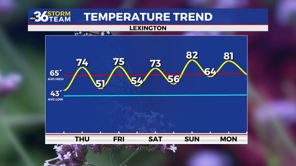
Heading into the late week an approaching cold front will bring our best chance for widespread rainfall across the area in quite some time. While it may not be enough to catch us up completely relative to our rainfall deficit, most spots should pick up a good quarter to half inch of rainfall with the best chances for totally close to 1 inch being across Southern and Southeastern Kentucky. Thursday definitely looks like a day when you’ll actually need to take the rain gear along. With clouds and rain around, afternoon highs will be held in check with low to mid-70s expected. We should dry out and warm-up heading into Friday with sunshine and highs in the mid-80s thanks to a southwest wind ahead of a secondary front that should follow suit heading into the weekend.
The aforementioned second front should quickly dive into the Ohio Valley Friday night and into Saturday morning bringing some additional scattered shower chances to the area. The data isn’t synced up completely on the timing of the front but most indicate that our rain chances should be confined to the overnight and morning hours of Saturday with things drying out during the afternoon. This is critical of course with the Cats opening SEC play at Kroger Field against Ole Miss at 3:30pm on Saturday. There could be a few lingering showers for tailgating but it should dry out and feel pretty comfortable for an afternoon game in early September as this front will bring a reinforcing shot of cooler and drier air so afternoon highs will only reach the mid-70s. Saturday. High pressure will build in for Sunday and early next week with more fall-like air returning to the Bluegrass.


