Milder air returns quickly into the mid-week
We could make a run at record highs once again by Thursday
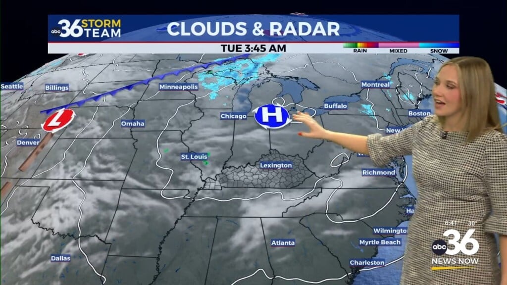
After a chilly start to the day with temperatures hovering around the freezing mark at daybreak in most locations, it was a pleasant late March Tuesday across Central and Eastern Kentucky. With high pressure sitting just to our northeast, we saw plenty of sunshine to go along with a few scattered clouds through the day. While afternoon highs did manage to recover into the mid to upper 50s, a steady east wind slowed down the warming process. That’s typically the case when we have cooler high pressure sitting over the eastern part of the Ohio Valley. Look for a quick rebound in temperatures as we roll into the mid-week.

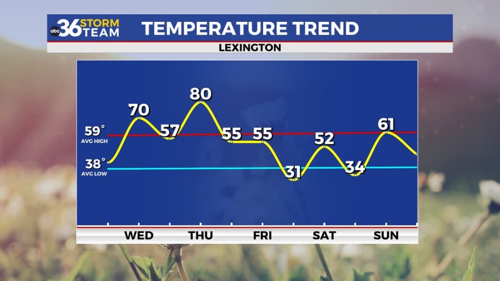
The aforementioned area of high pressure will slide eastward heading into Wednesday, allowing for winds to shift around to the south and southwest. This return flow will push more spring-like air back into the commonwealth so it should be noticeably milder on Wednesday. Throw in a good bit of sunshine along with a few clouds from time to time and it should be another delightful day. Afternoon highs will jump all the way back into the upper 60s and low-70s and that upward trend will continue heading into the late week.


While we are set-up for another brief stretch of unseasonably warm and possibly record setting temperatures on Thursday, the day may start out for a few scattered showers and thunderstorms as a mid-level wave of energy rolls through the region. While the best chances should be during the early morning hours before daybreak, a few showers/storms could hang around after the sun comes up before they move out. Much of Thursday should be partly sunny and unseasonably warm as a strong southwest wind makes it feel almost summer-like again. Afternoon highs should run back toward the 80 degree mark, which would tie the record high for Thursday here in Lexington set back in 2007.


All this warmth will be ahead of a strong cold front that will drop through the commonwealth on Friday. This looks to be a repeat of what we just a few days ago on Sunday and Monday as the best chances for organized severe storms stay just to our north given the timing of the front, although the Storm Prediction Center has areas along and north of I-64 in a Level 1 severe risk (out of 5) for late Thursday night and into early Friday. It should be a case where the storms weaken out as they drop southward overnight. Cooler air will slide in behind the departing front should look for “highs” right around midnight as temperatures slowly drop through the day with readings in the upper 40s by late afternoon.

High pressure will build in for the upcoming weekend and while it will be a cool Saturday, the weather should cooperate nicely for any outdoor plans you may have. The early mornings will be chilly with temperatures in the upper 20s and low 30s so keep that in mind. We’ll finish out the final weekend of March in style with more sunshine expected and afternoon highs back in the low-60s. The upward trend of temperatures continues early next week with a few low end shower chances as highs jump back into upper 60s and low 70s.

ABC 36 Storm Team 3 Day Forecast
Tuesday night: A few clouds and cool. Lows in the low-40s. Wind: SE 5 mph.
Wednesday: Partly sunny and milder. Highs in the upper 60s and low-70s. Wind: S 5-10 mph.
Wednesday night: Mostly cloudy with late showers and storms possible. Lows in the mid to upper-50s. Wind: SW 5-10 mph.