Legitimate rain and storm chances finally return into the mid-week
After a few light showers teased the Bluegrass on Monday, more widespread activity is on tap Wednesday and Thursday
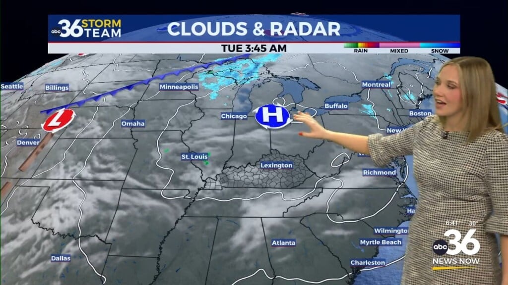
It was a cloudy start to Monday across Central and Eastern Kentucky (at least early) thanks to a weakening boundary sliding through the commonwealth. This boundary managed to squeeze out a few light showers in the Lexington area and up I-64 but overall it didn’t amount to much. Drier air worked in from west to east through the course of the day, allowing for sunshine to return and pushing afternoon highs into the low 80s in most locations.

Heading into Tuesday, unseasonably warm temperatures are on tap for the area with mostly sunny skies expected. Afternoon highs should make a run into the low to even mid-80s (especially here in the Bluegrass) given the abundant sunshine and the fact that the ground has really dried out lately, making it easier to heat the surface up.

A slow moving wave of low pressure will creep to the east into Wednesday and Thursday bringing our first legitimate rain chances to the commonwealth in quite some time. Expect rain and even some thunderstorms this time scattered about the area both Wednesday and especially Thursday. The ground has gotten pretty dry over the last several weeks so we could use the rain for sure. The latest Drought Monitor has parts of Central and Northern Kentucky in the “abnormally dry” range but hopefully this expected rain will help. Some of the data is indicating we could see a general .50″ to one inch rainfall totals with localized higher amounts. It would definitely help to get some water in the ground given the expected pattern shift this weekend.


We’ll head back into a dry and warm pattern to close out September and head into early October. High pressure should take hold of the Eastern U.S so expect warm and sunny days and mostly clear and pleasant nights all the way into next week. The extended outlook for rainfall has all of Central and Eastern Kentucky drier than normal through the first several days of the new month so that’s something we’ll need to keep an eye on.

ABC 36 HOUR FORECAST
MONDAY NIGHT: Mostly clear and pleasant. Lows in the upper-50s.
TUESDAY: Mostly sunny and warm. Highs in the low to mid-80s.
TUESDAY NIGHT: Clouds increase, a few storms possible. Lows in the low-60s.