Heavy rain and severe threat continues Wednesday into Wednesday night
Meteorologist Dillon Gaudet has the latest in your full ABC 36 Storm Team forecast
LEXINGTON, Ky. (ABC 36 NEWS NOW) – Good morning Kentucky, we are tracking the threat of heavy rain and severe thunderstorms for your Wednesday and Wednesday night. There is a Level 3 Severe Risk out for all of the ABC 36 viewing area with an added Level 4 Severe Risk for areas west of Bowling Green in western Kentucky. On top of the severe threat, there is a heavy rain threat that could result in localized flash flooding late this evening into the overnight hours.
![]()
A Flood Watch has been issued for central and eastern Kentucky until 8 a.m. Thursday morning. A widespread swatch of 1-3 inches of rain is likely, with locally higher amounts possible within the stronger thunderstorms.

There is still uncertainty around our afternoon and early evening severe weather threat. The morning line of showers and storms is leaving behind an area of “cooler” more stable air, while the more unstable air positioned to the south. This could lead to a lower severe weather threat for us here locally later this afternoon, with a lack of instability for supercell thunderstorms to form. There is still the chance that the unstable air on the southside of the southside of the boundary to our south, lifts to the north later today. If this were to take place, that increases the risk of supercell thunderstorms developing which would lead to a great severe threat.
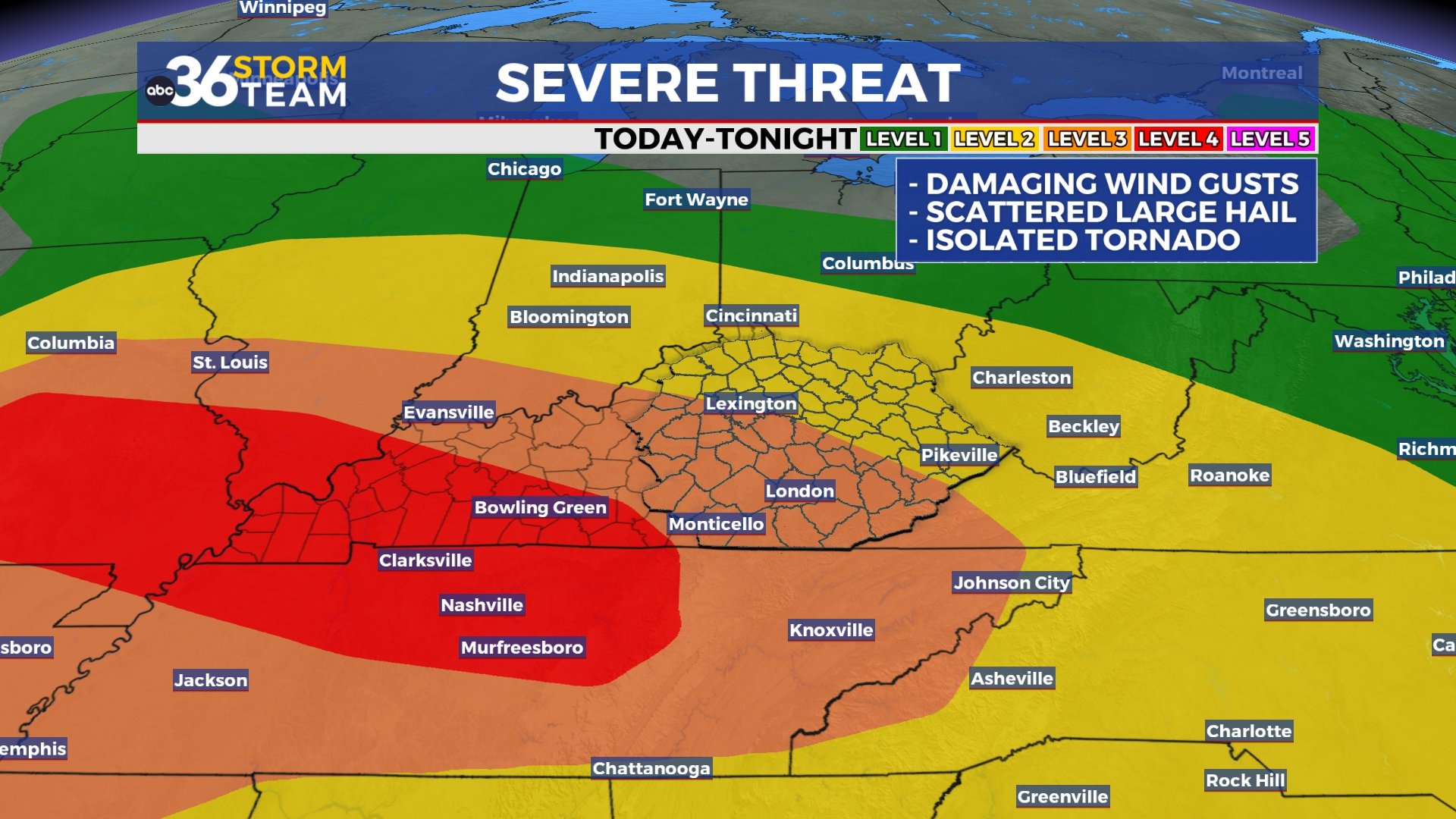
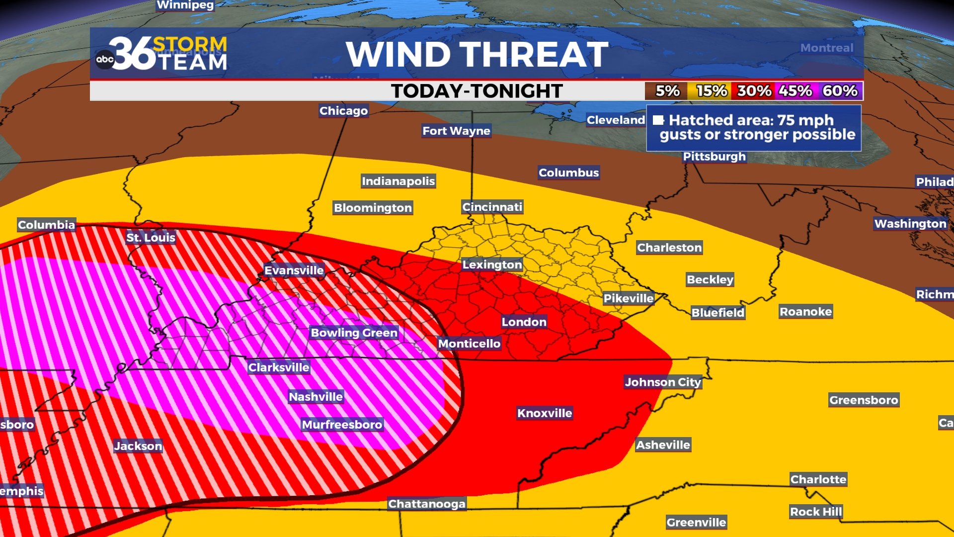
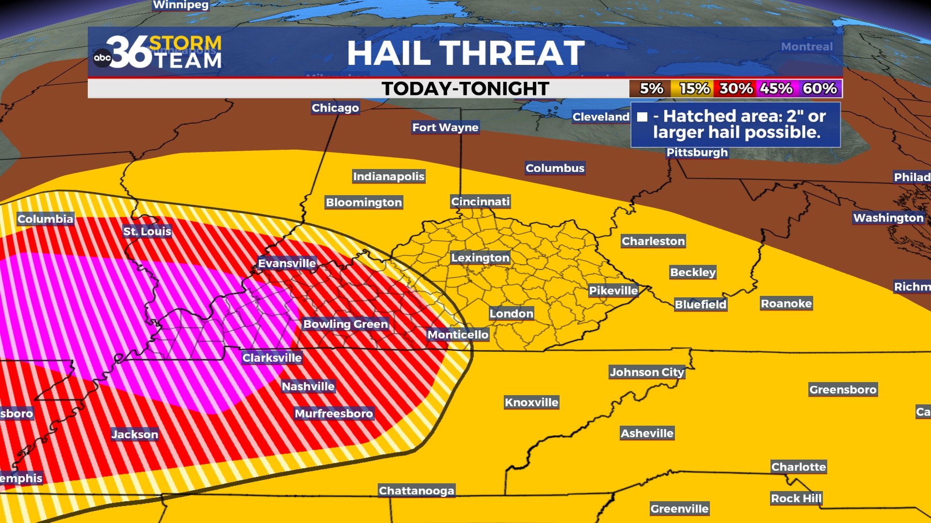

We are STILL expecting a line of severe storms to move through late this evening into the overnight hours, regardless of if we experience the afternoon strong storms or not. This will lead to widespread heavy rainfall and the threat of severe weather. All types of severe weather will be possible, with damaging wind gusts and large hail as the primary threats. Isolated spin-up tornadoes will also be possible along that line of storms.
By Thursday morning, showers and storms will be exiting the region to the south and the east. There is still a low-end severe risk for far southeastern Kentucky on Thursday as a cold front won’t be moving through until later in the day. As that front passes you can expect cooler air to move in for your Friday and Saturday. Afternoon highs will struggle to reach the upper 60s with daily off and on rain chances. Things will be drying out into Mother’s Day as high pressure builds across the region.
Stay with the ABC 36 Storm Team for more updates.
ABC 36 HOUR FORECAST
WEDNESDAY: Morning storms, a break, then more storms later on. Highs in the low-to-mid 80s. Flash Flood Watch
WEDNESDAY NIGHT: Heavy rain and strong storms likely. Lows in the 60s. Flash Flood Watch
THURSDAY: Lingering showers and few storms into eastern Kentucky. Highs in the 70s.


