Heavy Rain and Flash Flooding Threat Continues Into the Weekend
Isolated Severe Storms Possible Today; Organized Storm Clusters and Increasing Heat Arrive by Early Next Week
Heavy Rain and Flash Flooding Threat Moves In
A slow-moving line of showers and storms continues to push east out of western Kentucky and Indiana this afternoon, bringing very heavy rainfall to some areas. Rainfall rates of 2–4 inches per hour are possible in the heaviest storms, which could quickly lead to flash flooding—especially in locations that picked up heavy rain the past several days. If you’re in a flood-prone or low-lying area, stay weather-aware and be prepared to move to higher ground if a Flash Flood Warning is issued.
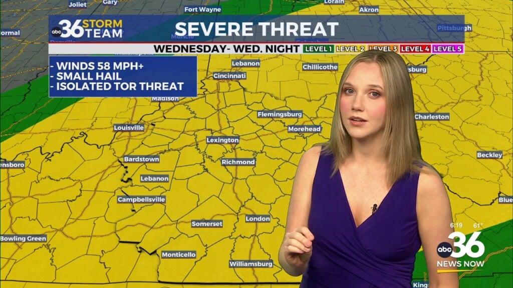
Isolated Severe Storms Possible
The Storm Prediction Center has placed all of central and eastern Kentucky under a Marginal Risk (Level 1 of 5) for severe weather today. While widespread severe storms aren’t expected, a few isolated storms could produce gusty winds, torrential downpours, and frequent lightning. The best chance for stronger storms will be in areas that see repeated rounds of thunderstorms through this evening.
Scattered Showers and Storms This Weekend, Then Building Heat
The unsettled weather pattern continues through the rest of the weekend, with organized storm clusters expected Saturday evening and Sunday. The Weather Prediction Center has placed much of eastern and central Kentucky under a Moderate Risk for flash flooding (Level 3 of 4) for Saturday, and a Slight Risk for flash flooding( Level 2 of 4) for Sunday. If you’re camping, hiking, or spending time near creeks or rivers, make sure you have a reliable way to receive weather alerts and know your evacuation routes in case flooding develops.
By early next week, a ridge of high pressure will build in from the south, shifting the focus from flooding to heat. Afternoon highs will climb into the upper 80s and lower 90s, but the humidity will make it feel much hotter. Heat index values could push 100–105° or higher by midweek, so plan for heat safety if you’ll be outdoors for long periods.
Stay Weather Aware
Given the continued risk of flash flooding and isolated strong storms, stay alert for the rest of today and into Sunday. Keep an eye on radar, and if you’re outdoors or traveling, turn around, don’t drown if you encounter flooded roadways.
We’ll keep you updated with any alerts or forecast changes as conditions evolve.