Haze and residual smoke particles from the Canadian wildfires are back to end the week
That should be the only blemish in our forecast as dry conditions should be the rule for much of the upcoming holiday weekend.
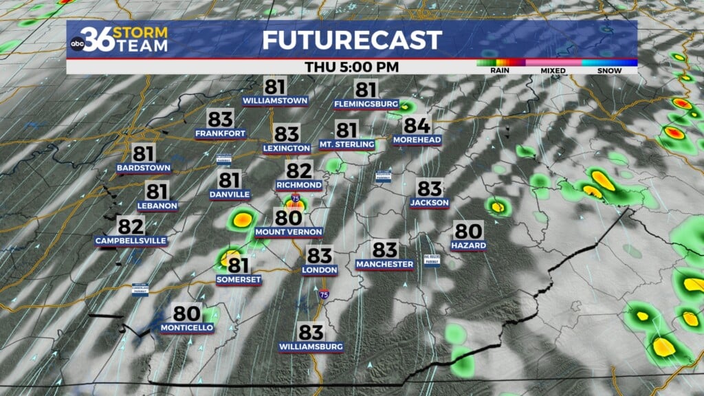
It was a warm and dry Thursday across Central and Eastern Kentucky but you probably noticed the return of hazy skies due to more smoke particles from the Eastern Canada wildfires drifting into the Ohio Valley. That upper low from earlier this week exiting to the east helped push some of the haze and smoke into the region and we’ve actually got more on the way heading into Friday. Despite the haze, afternoon highs climbed into the low to mid-80s on Thursday so it felt more like mid-June, especially compared to earlier this week.
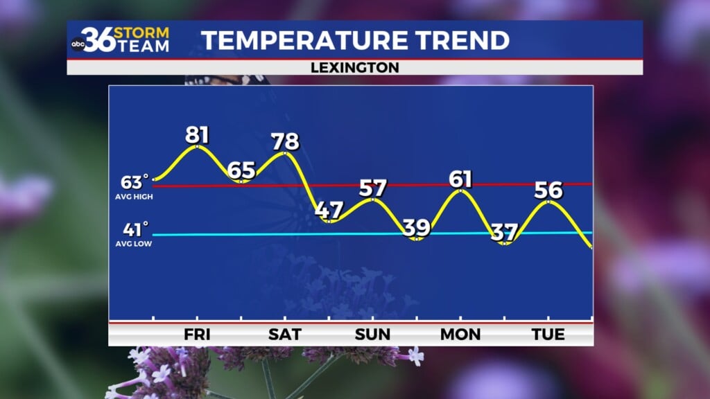
In addition to more haze/smoke behind the frontal boundary on Friday, expect a northwest wind which will help to knock afternoon highs down a few degrees thanks to a shot of slightly milder air. Even though we’ll see plenty of sunshine, I think the combination of the haze and winds out of the northwest will hold afternoon highs into the upper 70s to around 80 degrees in most locations. Regardless it looks decent to close out the week.
Heading into the long holiday weekend, our weather here in Central and Eastern Kentucky looks really nice especially on Saturday. With high pressure in control we should enjoy plenty of sunshine and less haze as afternoon highs reach the low 80s! This will be the best day of the weekend for outdoor activities. There is some good news for Father’s Day as the next wave of low pressure should continue to slow its eastward progress. This will keep the rain chances out for all the Dad celebrations going on as afternoon highs surge through the mid to upper 80s with the rain holding off. It may be a bit more humid on Sunday so plan for that if you’ll be outside for any length of time.
The aforementioned wave of low pressure will eventually arrive here in the Ohio Valley on Juneteenth Monday. This will increase our chances for scattered showers and storms so it should be wet and stormy from time to time on the holiday. Much of the data is showing the low will be cutoff from the upper level winds causing it to stall out and just spin over the region through much of next week. This will mean a daily chance for rain and storms, mainly during the afternoon and evening hours. The best chance for heavier rain will be on Monday, which wouldn’t be a bad thing considering the latest “Drought Monitor” has improved only slightly this week and mostly in areas of Southeastern Kentucky where the heaviest rain fell the last week. The bottom line if we could use more rain and we should get it next week.
ABC 36 HOUR FORECAST
THURSDAY NIGHT: A few clouds and mild. Lows in the low 60s.
FRIDAY: Hazy sunshine and pleasant. Highs in the upper 70s to around 80 degrees.
FRIDAY NIGHT: Clear skies and pleasantly cool. Lows in the mid-50s.


