Feeling like the spring across the region the next few days
Look for consistent shower chances and possible record warmth by Friday
Mother Nature flipped the script quickly on Tuesday as a warm front lifted northward through the commonwealth bringing a return of milder air. Gone were the chilly temperatures in the 30s that we dealt with to start the week, replaced by afternoon highs back into low to mid-60s thanks to a breezy south wind. With some energy riding along the front as it stalled out along the Ohio River, scattered showers moved through the area with a few rumbles of thunder in there as well but much of it moved out by the mid to late afternoon. This mild and unsettled weather pattern will be a prelude of things to come the rest of the week.

With the aforementioned front camped out just to our north, temperatures will remain on the pleasant and mild side heading into Wednesday with readings in the mid-50s as you head out the door in the morning. More energy riding along the boundary is expected to trigger additional showers and a few storms during the day with the most favorable area being the northern half of the state, which is closer to the front. In fact some areas of Southern and Southeastern Kentucky may end up rain free through the day. This should set up a decent temperature gradient from north to south with highs in the upper 60s here in the Bluegrass with mid-70s down south where it is dry. There is the potential of some hail producing storms late Wednesday and into early Thursday along the I-64 corridor northward and the Storm prediction Center has that part of the state in a Level 1 severe weather risk (out of 5) to account for that.


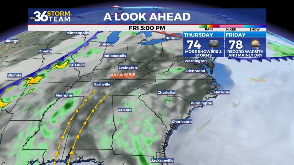
A more significant wave of energy will help pull the frontal boundary a bit closer on Thursday so more showers and storms are expected across the area. Temperatures will continue to feel very spring-like and then some as afternoon highs climb all the way into the low to mid-70s Thursday even with the clouds and some rain/storms around. The front should lift back to the north a bit in response to a wave of low pressure developing well to our west on Friday, keeping us in the very mild to warm air. In fact with a mainly dry Friday on the table now along with some sunshine, record high temperatures may be possible as readings reach the upper 70s and even approach 80 degrees across Southern Kentucky. The record high for Friday in Lexington is 77 degrees set back in 1973 and it appears we have a chance to best that mark.


Heading into the weekend, the warm and wet pattern will remain in place as a front moves in from the northwest supported by an area of low pressure. With plenty of warm, moist air in place, showers and thunderstorms are expected once again and given the time of the year it is, we’ll have to watch for the potential of a few strong to severe storms as we draw closer to that time frame. Afternoon highs should still reach the low to mid-70s even with the storm chances around. Some of the data is showing a weakening of the frontal boundary by the end of the weekend and into early next week, essentially washing it out over the region. This would lessen our rain chances during that window with afternoon highs backing off a few degrees into upper 60s to low-70s but it will still feel great for early March. Hopefully the drier trend for that period continues as the consistent rain in the coming days may cause a few minor flooding issues in areas that typically see it after a wetter period.


ABC 36 Storm Team 3 Day Forecast
Tuesday night: Scattered showers, mainly . Lows in the mid-50s. Wind: SW 5-10 mph.
Wednesday: Mild with scattered showers and storms. Highs in the upper-60s and low-70s. Wind: SW 5-10 mph.
Wednesday night: More rain and storms, especially north. Lows in the upper-50s. Wind: S 5-10 mph