Dry and pleasant air settles in to close out the week
Temperatures should be a bit below average Friday with lower humidity levels
It turned out to be a pretty decent Thursday weather-wise across Central and Eastern Kentucky as the frontal boundary that kept things wet and stormy through the mid-week finally made its way to the east. The combination of the sunshine and a breezy west wind allowed afternoon highs to climb back into the low 80s despite the passage of the aforementioned front. The reason for this is a secondary boundary that is the leading edge of a drier and milder air-mass, which will settle into the commonwealth nicely as we close out the week.
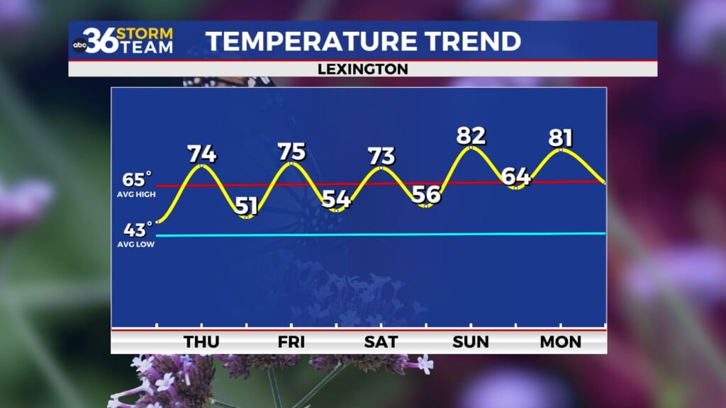
Friday looks to be quite pleasant for early June around the area with a good bit of sunshine and a west to northwest breeze continuing to push more comfortable air into the region. One thing you should notice is that it won’t feel nearly as muggy as it has much of the week, which will be a nice change of pace. We should see a few scattered fair weather clouds develop through the afternoon but otherwise it looks great with the fresh breeze helping to keep things nice as afternoon highs remain in the mid-70s in most locations.
Heading into the weekend the overall forecast looks pretty good but as always the devil is in the details. The model data still isn’t synced up relative to our overall shower chances (which aren’t overly high to begin with) and the majority of the data is indicating the chances will be at a minimum. Out in-house model is trying to push some moisture back in by Saturday morning but that could be an anomaly so we’ll watch the overall trend. A weak boundary looks to move through the area late Saturday and into early Sunday so that could be our best chance for a few showers. For now we’ll keep the low end shower chances in place for the weekend but don’t change any outdoor plans as we aren’t looking at a wash-out. Highs will remain just below average into the upper 70s.
Heading into next week the general trend is for a mainly dry and slowly warming forecast as we rapidly head into the middle part of June. Some upper level energy looks pass overhead Monday but there shouldn’t be a lot of moisture to work with so just an isolated shower is possible. By the middle of next week it looks dry and warm with afternoon highs getting back to average into the low to mid-80s next Wednesday and Thursday.
ABC 36 HOUR FORECAST
THURSDAY NIGHT: Mostly clear and cooler. Lows in the mid-50s.
FRIDAY: Mostly sunny and pleasant. Highs in the mid-70s.
FRIDAY NIGHT: Fair skies and quiet. Lows in the mid to upper-50s.


