Dodging showers this weekend with more wind on tap early next week
It shouldn't be a washout either weekend day as we focus on another potential strong wind event to kick off next week
It was a much colder Friday across Central and Eastern Kentucky as afternoon highs dropped back to around average for late February, topping out in the 40s. This was a far cry from the spring-like air and highs well into the 70s we enjoyed on Wednesday and Thursday. Although we did have some clouds and a cool northeast wind to contend with Friday, there was a bit of sunshine to bookend the day, staring with some delightful sunrise shots.
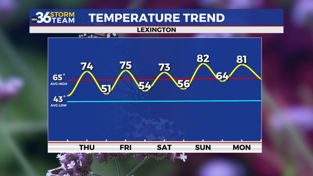
Heading into the weekend, we’ll be dodging a few showers from time to time but it won’t be a washout by any means. In fact the timing looks pretty good with the best chance for showers Saturday morning, and then again late on Sunday so the bulk of the weekend may end up dry. With some sunshine expected Saturday afternoon, highs will sneak back into the low 50s before climbing into the upper 50s on Sunday before the next round of showers moves in.
We’ve had a number of strong wind events this winter across Central and Eastern Kentucky and it appears that another one will be on the table for Monday. With a strong area of low pressure wrapped up and passing by to our northwest, strong and potentially damaging winds will be possible on Monday with the data indicating gusts 50 to 55 miles per hour with some locations even higher. This could be comparable to the wind event on February 9th when we had wind gusts over 60 miles per hour in many locations so be prepared for that heading into next week.
In addition to the week, rain and storms will be possible and a few of those storms could be severe, especially given how strong the overall wind fields will be. The Storm Prediction Center already has Central and Eastern Kentucky in the extended severe weather outlook for possible severe storms Monday so stay tuned.
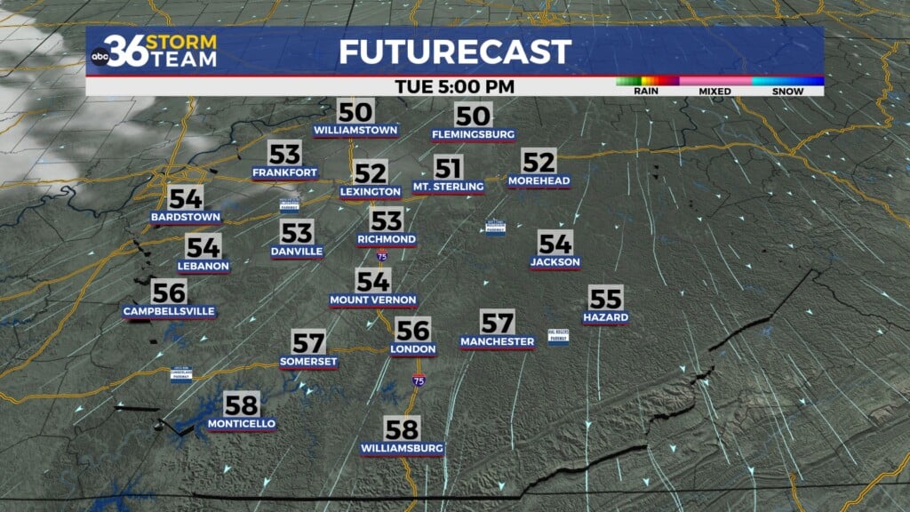
As we close out February and kick off March, we should squeeze a couple of dry days in, and the bonus is that we aren’t expecting any big push of colder air behind Monday’s system so we should enjoy highs in the mid-50s Tuesday before jumping into the upper 60s to kick off March as a warm front moves through. Have a great weekend!
ABC 36 HOUR FORECAST
FRIDAY NIGHT: Mostly cloudy, a few showers possible. Lows in the upper-30s.
SATURDAY: A.M. showers south then partly sunny. Highs in the low-50s.
SATURDAY NIGHT: Mostly cloudy and cool. Lows in the upper-30s.


