Delightful weather on tap as May comes to a close
Temperatures look to be a bit cool Friday morning with lows dipping down into the upper 40s!
It was another pleasant day Thursday across Central and Eastern Kentucky as the finish line approaches for the month of May. With a mix of clouds and sunshine and less of a breeze than what we had to deal with Wednesday, afternoon highs reached the low to mid-70s in most locations. Drier air moved in as high pressure dropped into the Great Lakes keeping things tranquil across the area so the quiet weather is a very welcome change after the stormy May we’ve seen across the Ohio Valley.
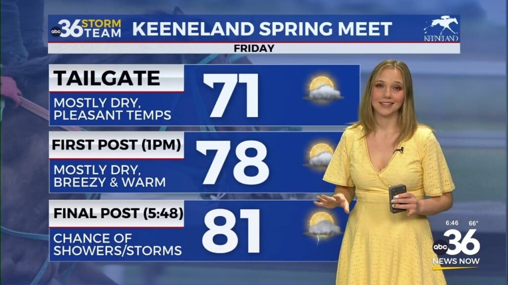
We should finish off the month of May in style on Friday as the aforementioned area of high pressure settles into the eastern part of the Ohio Valley. Depending on your tolerance level you may need a light jacket out the door early Friday as temperatures drop down into the upper 40s with a few outlying spots looking at mid-40s thanks to the clear skies and light winds overnight. Expect lots of sunshine through the afternoon hours with a pleasant east wind. Temperatures should top out into the mid to upper-70s in most spots with lower humidity levels staying put for another day.
As we welcome June on Saturday a weakening area of low pressure will slide in from the west. Winds will shift around to the southwest increasing the moisture over the region and helping to push our afternoon highs back into the low-80s. Based on the latest model data we are still looking at isolated to scattered storms possible late in the day so hopefully this system will have minimal impacts on all the events going on outdoors across the area. It appears the bulk of the rain/storm chances will be Saturday night with a few leftover showers Sunday morning before we dry out it. That’s definitely a positive trend and the additional sunshine will provide for another warm day on Sunday with highs in the low 80s.
No major changes in the extended forecast are expected as a “summer-like” pattern kicks in much of next week. The upper level flow will be well to our north so expect a few weak “waves” of energy to cruise through from time to time. No day should be a complete wash-out and right now the most organized activity may be on Wednesday and Thursday. It will be a bit on the muggy side, which will helps trigger the storms through the afternoon and early evening hours as temperatures remain warm in the low to mid-80s for afternoon highs.
ABC 36 HOUR FORECAST
THURSDAY NIGHT: Mostly clear and cool. Lows in the upper-40s.
FRIDAY: Mostly sunny and nice! Highs in the mid to upper-70s.
FRIDAY NIGHT: A few clouds and quiet. Lows in the mid-50s.


