December thaw continues into the mid-week
Even with some clouds around highs should be around average
It felt much better across Central and Eastern Kentucky on Tuesday after the quick shot of Arctic air that plunged the region into the deep freeze for a short spell late Sunday and into Monday morning. A mid-level cloud deck held temperatures into the mid to upper 20s to begin the day, which felt downright balmy after the single digit readings early Monday. With a persistent southwest flow and even some unexpected clouds overspreading the region, afternoon highs climbed back toward the 40 degree mark here in the Bluegrass with mid-40s across the south and east. Luckily this upward trend will continue into the mid-week.
A weak wave of energy looks to slide through the region from the southwest heading into Wednesday so a few clouds will be around, which should help to hold early morning lows into the mid to upper 30s, so it won’t feel overly cold heading out the door. There may be enough moisture to squeeze out a shower or two across Southern Kentucky but most locations should be dry. Hopefully we can catch a few rays of sunshine but even without that, the steady southwest breeze will help push afternoon highs back into the mid to upper 40s here in Central Kentucky with a few low-50s down south. This should feel quite comfortable after the recent cold and put us at or slightly above average for highs.
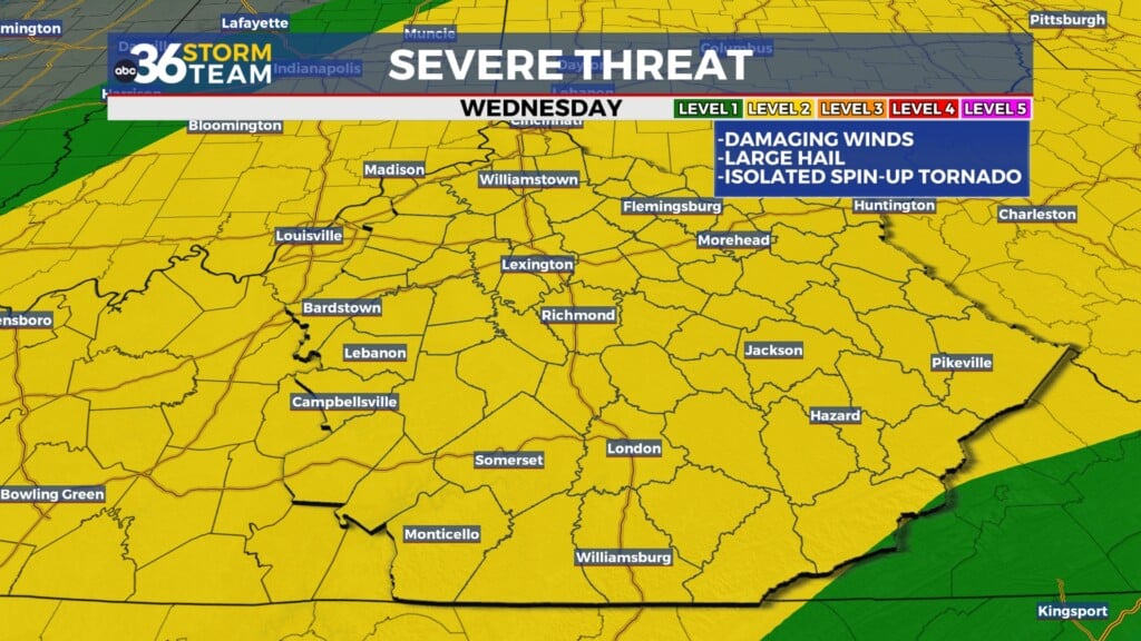
Our next storm system will drop through the Ohio Valley on Thursday bringing wind, rain and even milder air to the commonwealth. Winds will crank up out of the southwest with gusts over 30 miles per hour at times helping afternoon highs into the mid to upper 50s across the board. Scattered rain will be possible before a gusty line of showers and a few thunderstorms (a few embedded could be on the strong side with a low end Level 1 severe risk late Thursday from the Storm Prediction Center due to the wind) rolls through on the nose of the front. As the front moves east, temperatures should drop pretty quickly behind the front with much colder air arriving for Friday. We’ll see the typical scenario of “catch me if you can” with the colder air trying to reach the moisture before it exits. There is the chance of a few snow showers and flurries Thursday night and into Friday (especially in the east) but the overall impact should be minimal. Winds should be strong enough to dry out most roadways but a few slick spots can’t be ruled out early Friday. Afternoon highs will only be in the low to mid-30s so it will be a brief reminder that winter is basically here.
Heading into the weekend look for temperatures to rebound quickly as a warm front arcs through the region during the early morning hours. temperatures should actually rise Friday night and a southwest wind will help push temperatures back into the low-50s by the afternoon hours. While Saturday looks mainly dry, a few spotty showers will be possible into Sunday as a weak front moves in but it shouldn’t amount to much. Temperatures should back down into the upper 40s to welcome the winter season officially early Sunday as the Winter Solstice occurs at 10:03 am. Looking ahead to Christmas week. Additional low end shower chances may be possible late Monday and into Tuesday as temperatures climb back above average so it’s looking relatively mild for the holiday at this point.
ABC 36 Storm Team 36-Hour Forecast:
Tuesday Night: A few clouds, cool temperatures. Lows in the mid to upper 30s. Wind: SW 5-10 mph.
Wednesday: Partly cloudy and a bit milder. Highs in the mid to upper-40s central with low-50s south. Wind: SW 5-10 mph.
Wednesday Night: More clouds, steady/rising temperatures. Lows in the upper 30s early rising to the low-40s. Wind: SW 5-10 mph.


