Damaging wind gusts, severe storms likely Friday
Meteorologist Dillon Gaudet has the latest in your ABC 36 Storm Team forecast
Heavy rain, damaging wind gusts and severe storms will impact Central and Eastern Kentucky on Friday. After morning rainfall exits, we’ll be tracking a bit of a break that will last through the mid-to-late morning. This will lead to strong-to-severe storms and damaging wind gusts for midday and afternoon. Make sure you stay “Weather Aware” today. That includes having multiple ways to receive weather alerts, reviewing your severe weather plan and taking shelter if severe weather strikes near you.

Friday’s weather impacts will come in three rounds:
Round 1: Heavy rain with a flood potential Friday morning.
Round 2: Line of strong-to-severe storms and damaging wind gusts.
Round 3: Lingering gusty winds.

Heavy rain Friday will impact much of the region Friday morning. A Flood Watch is in place for Lexington northward due to the possibility of flash flooding from the early day heavy rain. A total of 2-3 inches of rain is in the forecast with heavier amounts possible closer to the Ohio River.
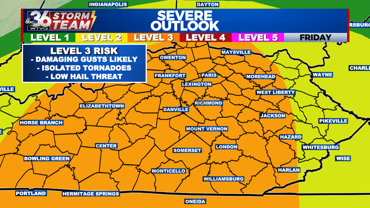
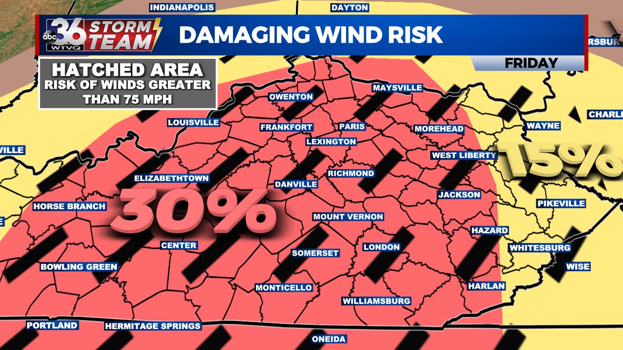
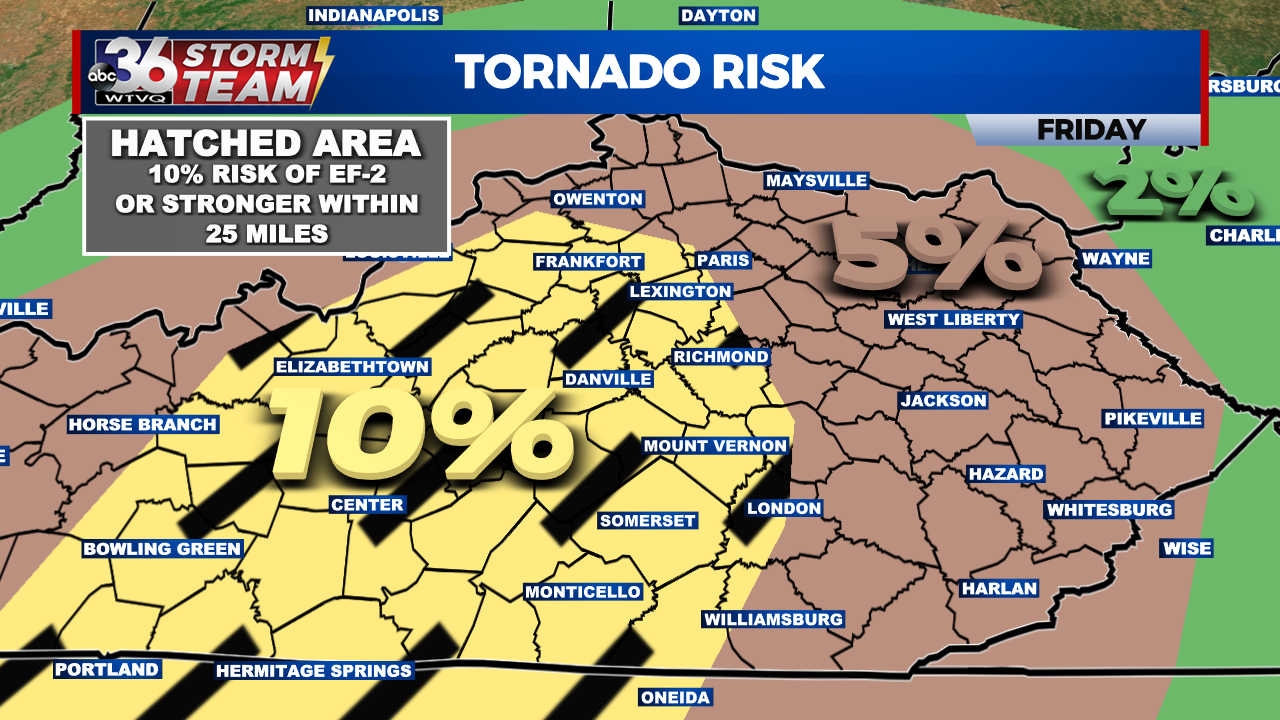
There will likely be a bit of a break after the early morning heavy rain. This will allow for a line of strong-to-severe thunderstorms to strengthen as it travels west to east across Kentucky. Damaging wind gusts will be the primary threat with this line of storms. Isolated tornadoes will also be possible thanks to the rotating nature of the storms. The Storm Prediction Center has increased the risk of EF-2 or stronger tornadoes for central Kentucky. Meaning there is a 10% chance of an EF-2 or stronger tornado within 25 miles of any location within any point in central Kentucky. There is also the chance of isolated large hail, mainly in central Kentucky.

A High Wind Warning is placed for a large section of the ABC 36 viewing area through Friday night. Sustained winds of 20-40 mph and gusts upwards of 55-65+ mph are in the forecast. Tree damage, power outages, and difficulty driving high-profile vehicles will all be possible. High wind gusts will persist after the strong-to-severe storms pass and will likely last through the evening hours.

As the system exits Friday evening, temperatures will drop by Saturday morning. The snowflake chance that appeared likely a few days ago has diminished for Saturday morning. The weekend forecast continues to improve as well. After a cooler day in the 40s and low 50s on Saturday, temps will climb near 60 on Sunday.


