April showers and storms to close out the month
A weak front should keep things a bit damp for the final day of April
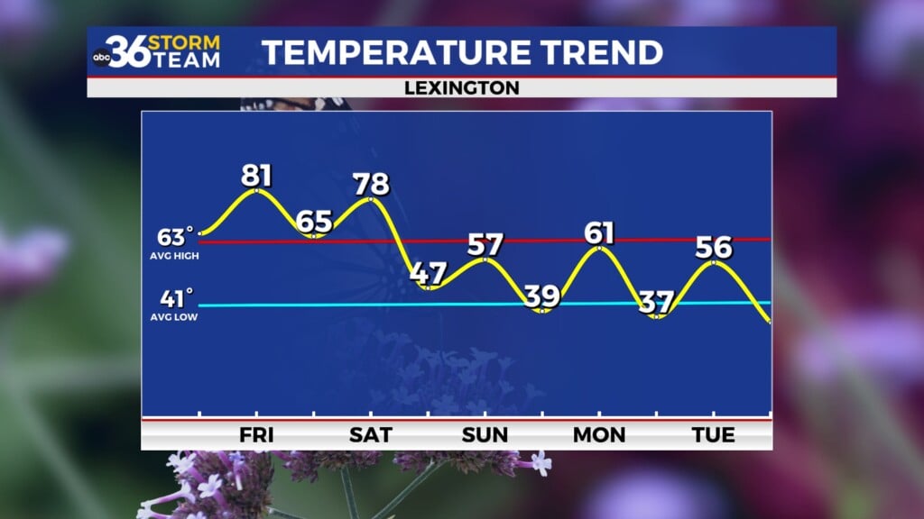
It was a delightful start to Derby week across Central and Eastern Kentucky on Monday with sunshine, a nice southwest breeze and afternoon highs climbing into the upper 70s and low 80s. This was a continuation of what was a very delight final weekend of April but it looks like we’ll have a minor speed bump with our dry weather pattern and summer-like temperatures as we close out the month.

A weakening frontal system will make a run through the Ohio Valley on Tuesday with scattered showers and storms possible, especially during the first half of the day. Overall there should just be your garden variety rain and storms but a few of the more organized storms could produce some gusty winds, heavy rain and small hail even though we aren’t expecting any organized strong/severe storms. With the clo9uds and rain around coupled with winds shifting to the northwest behind the departing front, afternoon highs will be a touch cooler on Tuesday but still pleasant as readings top out in the low to mid-70s. Most locations should see upwards of a half inch of rain with a few spots seeing more where any heavier downpours occur.


We should kick off the month of May in style as we dry out, the sunshine returns and winds make a quick shift around to the southwest heading into the mid-week. Both Wednesday and Thursday look very nice as temperatures recover back to the summer-like feel we’ve enjoyed the last few days. Afternoon highs should work back into the low 80s for the first day of May with mid-80s possible on Thursday. This should make for a delightful “Thurby” up at Churchill Downs in Louisville as the countdown is on toward the big race on Saturday.

Speaking of the Derby, it appears a frontal system will be moving in from the west on Friday so our rain and storm chances may be ramping up on Oaks Day. This could mean a damp day and a wet track for the fillies big race late Friday afternoon. Highs should reach the mid to upper 70s despite the rain so temperatures won’t be an issue. As far as Derby Day 150 is concerned, it may start out a little wet with some leftover showers during the morning and some of the data is trying to hold some additional moisture back even into the afternoon hours so the timing will be critical. One good things is the it appears the farther west you go (back toward Louisville) the better chance it will be dry by post time Saturday evening. Temperatures should be in the low 70s for highs, which is right around average for early May. We’ll keep you posted.


ABC 36 HOUR FORECAST
MONDAY NIGHT: Mild with showers and storms. Lows in the low-60s.
TUESDAY: More rain and showers, ending late. Highs in the mid-70s.
TUESDAY NIGHT: Mostly clear, pleasantly cool. Lows in the low-50s.


