Active weather pattern kicks in this week
Multiple chances for rain are on the horizon in the coming days
After a record setting start to the week across Central and Eastern Kentucky with temperatures surging into the low 70s with a spring-like feel, a cold front dropped through the area early Tuesday bringing cloud cover and cooler temperatures. While our official highs for Tuesday occurred just after midnight with readings in the low 60s here in the Bluegrass, much of the day was spent into the mid-40s in the central part of the state while far southern and southeastern Kentucky enjoyed another mild afternoon thanks to the front stalling out with temperatures there in the low 60s! We did manage to sneak in a few peeks of sunshine late in the day and hopefully you enjoyed it as the sun will be at a premium the next few days as an active weather pattern kicks in.
Wednesday looks to be an interesting day as far as our temperatures are concerned as a warm front is expected to be draped across the southern part of the state as an area of low pressure moves in from the west. The position of this front will be critical as areas north of the front will see an east wind and highs only in the low 40s, while areas south of the front (which should include much of Southern Kentucky) will surge into the upper 50s and low 60s with a south wind. As a result look for quite the temperature gradient across the commonwealth. It should be a wet midweek with more rain on the way along with a few thunderstorms in the warmer air south of the boundary. There is a Level 1 severe risk (out of 5) from the Storm Prediction Center for the southwestern part of the viewing area into Wednesday night where a few strong storms could producing some damaging winds and even a brief isolated spin-up tornado even though the risk is low.
Heading into Thursday, temperatures should rise during the early morning hours as the warm front arcs through the Ohio Valley pushing temperatures into the 50s by daybreak and low 60s into the afternoon. Additional rain is expected with solid 1″-2″ totals possible by the time the showers wind down late Thursday so this could create some high water issues in spots given the saturated ground. We will have a brief break in the action to close out the week Friday with cooler air returning as afternoon highs back down into the upper 40s.
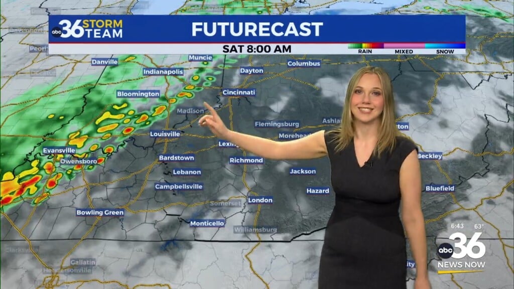
The unsettled weather pattern stays put for the weekend with another round of showers and a few storms expected through the day on Saturday. It does look like a wet day so keep that in mind if you have plans to be out and about. Temperatures will rebound into the low-60s for highs thanks to a southwest wind ahead of a cold front dropping in from the northwest. Once the boundary clears the area, cooler air will return with afternoon highs back closer to average for early February into the low-40s as some patchy drizzle hangs around to close out the weekend. Some of the data is indicating another wave sliding through early next week and with colder air in place, we could be back in the wintry mix mode so that’s something we’ll be watching into next week.
ABC 36 HOUR FORECAST
TUESDAY NIGHT: Mostly cloudy and cold. Lows in the mid-30s.
WEDNESDAY: Chilly with scattered rain, warmer temperatures south. Highs in the mid-40s central and upper 50s to low 60s far south.
WEDNESDAY NIGHT: Breezy with rising temperatures into the upper 50s by daybreak, more rain and storms.
TUESDAY NIGHT: Mostly cloudy and cold. Lows in the mid-30s.
WEDNESDAY: Chilly with scattered rain, warmer temperatures south. Highs in the mid-40s central and upper 50s to low 60s far south.
WEDNESDAY NIGHT: Breezy with rising temperatures into the upper 50s by daybreak, more rain and storms.


