Active weather into the holiday weekend but not a wash-out
Expect off and on showers and storms with the severe threat still on the table Sunday
Our unsettled and active weather pattern has kicked back in across Central and Eastern Kentucky and that’s going to be the case heading into the upcoming holiday weekend. After a morning round of showers and storms with some localized heavy rain, we saw a quick break and some clearing which allowed the atmosphere to recover and destabilize a bit. This helped fuel additional showers and storms, which a few of them could be on the strong to severe side Thursday evening. Similar to Wednesday evening, the activity will wind down late in the evening with a quiet overnight expected. All the low level moisture around should help some patchy dense fog to develop so keep that in mind Friday morning. Luckily we aren’t looking at an all day rain at any point through the holiday weekend but there are some times to watch for sure.
A lot of the data is is indicating we may end up being mainly dry through much of the day on Friday. With a warm front sliding to the north and a cold front well to our west, expect partly sunny skies with an outside shot at a thunderstorm during the afternoon. This will allow temperatures to climb into the low-80s for highs. The frontal boundary should draw closer by Friday evening so we may see a line of strong storms diving at that point. There is a Level 1 severe risk (out of 5) for the entire area which should mainly be a damaging wind threat along the potential line of storms later in the day.
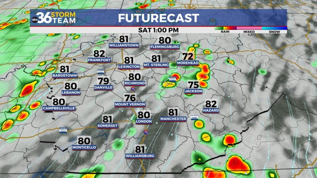
Heading into the holiday weekend it actually looks pretty decent with just a few isolated to scattered storms possible on Saturday. It should be another warm day with highs in the low to mid-80s so with plenty of folks with outdoor plans, this may be our best day of the 3 day weekend, especially considering what may be on tap for Sunday.
The organized severe weather threat is still legitimate and in play as we head into the day on Sunday. A strong wave of low pressure will be moving in from the west and the dynamics are in place for a severe weather outbreak across a good chunk of our region. Yes we are still a few days away but the data has stayed pretty consistent on the severe chances lately so we’ll have to monitor things closely.
One of the additional problems with this potential event is that it is occurring over a holiday weekend when many folks will be enjoy outdoor activities. Many times people check out and go “off the grid” from late Friday until late Monday over a holiday weekend, but that’s not something you’ll want to do if you have plans to be at the lake, camping, or doing any outdoor activities away from home. You need to stay weather aware through the day on Sunday. We could see multiple rounds of strong to severe storms both during the day and potentially into the overnight hours. The bottom line is HAVE A PLAN…know where to seek safe shelter if needed and have a way to get your alerts/warnings, which can be especially challenging in remote areas. Stay with the ABC 36 Storm Team for the latest updates through the holiday weekend.
ABC 36 HOUR FORECAST
THURSDAY NIGHT: Early storms, then patchy fog. Lows in the low-60s.
FRIDAY: Partly sunny and warm, storms late. Highs in the low-80s.
FRIDAY NIGHT: Storms early, then partly cloudy. Lows in the mid-60s.


