A quiet mid-week before more active weather returns to close out March
Get set for a few frosty mornings and sunny afternoons through Thursday before wet and windy weather returns on Friday
Mother Nature gave us a friendly remainder Tuesday that we are still in early spring as temperatures were a touch on the cool side, even for late March thanks to a mid-level wave of energy moving through the region. Other than a few sprinkles/passing showers in a few spots it was mainly cloudy and dry through the afternoon but the combination of a light north wind and the cloud cover held highs into the low to mid-50s. High pressure will help clear skies out into early Wednesday so temperatures should tumble to around the freezing mark so you’ll want to protect those sensitive plants.
With more sunshine around on Wednesday, it should be a pleasantly cool day after the chilly start as afternoon highs return into the upper 50s with a few spots down south reaching the 60 degree mark. A weak boundary to our north could throw a few clouds our way late as it weakens out but it will bring a slight re-enforcing shot of cool air so Thursday morning looks to be quite cold once again with lows into the low 30s.
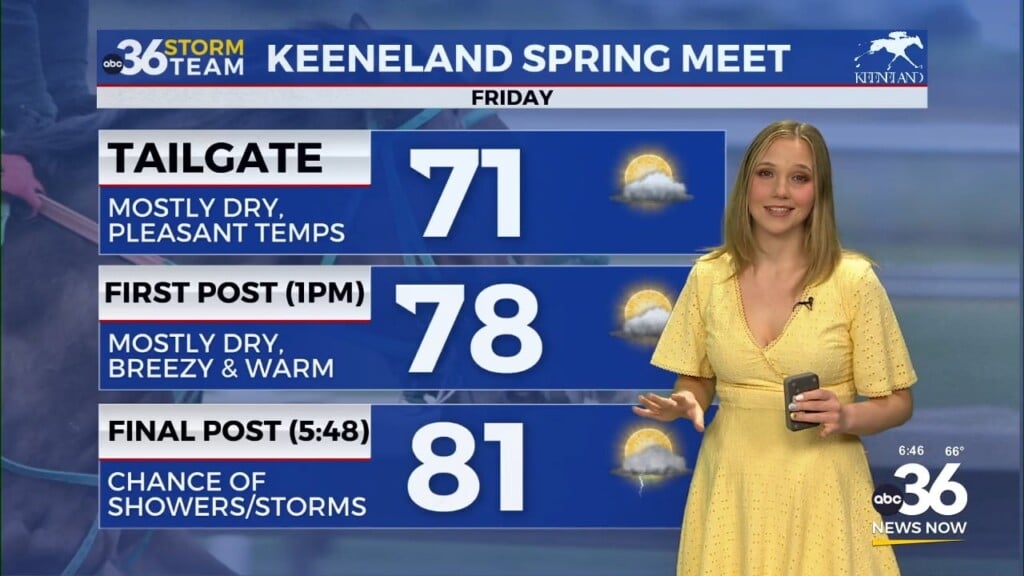
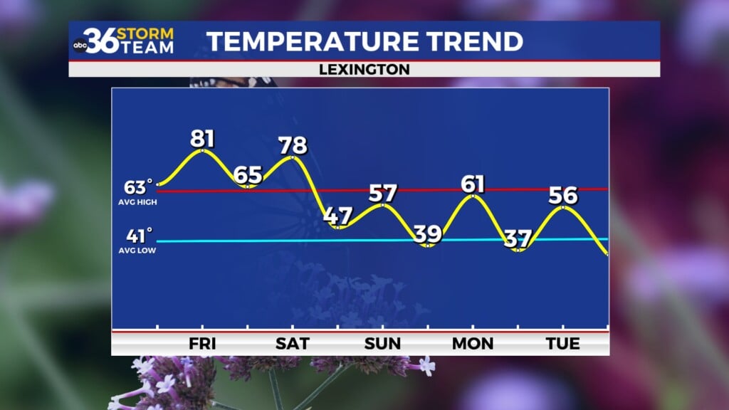
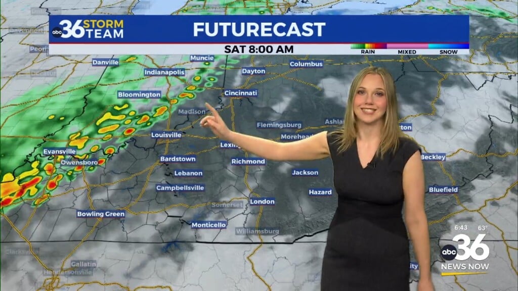
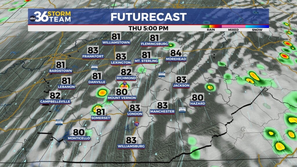
Our weather pattern gets more active as we close out the month heading into Friday. A secondary area of high pressure will provide more tranquil weather on Thursday with highs in the low 60s before our latest storm system cranks up in the Central Plains and makes a run for the Ohio Valley into Friday. Expect showers and storms for the final day of March, which will be more numerous later in the day as a southwest wind pushes highs into the upper 60s.
We are still monitoring for the heavy rain and severe storm potential with the late week system. The Storm Prediction Center with their Day 4 “Extended” severe weather outlook has pushed the possibility of a few strong storms farther east to include most of Central and Eastern Kentucky for late Friday evening. Several of the dynamics are in place for severe weather with the one key factor is the low about of instability or storm energy. That being said, the possibility of these stronger storms is still in play and you’ll want to be prepared especially as we enter our traditional severe weather season.
Yet again it appears the gradient winds behind the departing area of low pressure will be strong on Saturday, which is something that has become rather common lately here in Central and Eastern Kentucky. After the rain departs Saturday and the sun pops out, the gradient winds may gusts 40-45+ miles per hour for the second Saturday in a row! What a way to kick off April and that’s no foolin!!!
After a dry and cooler Sunday, more active weather is possible early next week as highs surge into the low to mid-70s with more storms (possibly strong) on the table late Monday and into next Tuesday. We’ll keep an eye on it of course!
ABC 36 HOUR FORECAST
TUESDAY NIGHT: Clearing skies, a cold night. Lows in the upper 20s and low 30s.
WEDNESDAY: Mostly sunny and pleasant. Highs in the upper-50s.
WEDNESDAY NIGHT: Mostly clear, cold again. Lows in the low 30s.


