A quick shot of chilly air before spring-like temperatures return
Rain and snow showers may be possible with highs in the 30s to kick off the weekend
After a damp Thursday across Central and Eastern Kentucky with several waves of rain moving through, it turned out to be a pretty nice finish to the week to the week on Friday. With no big push of chilly air behind the front and a good bit of sunshine around, afternoon highs recovered nicely into the upper 50s and low 60s which is still 10 degrees plus above average for the late part of February. With all the low-level moisture around from the rain Thursday and skies clearing out a bit, we saw see fairly dense fog in a few locations to begin Friday.


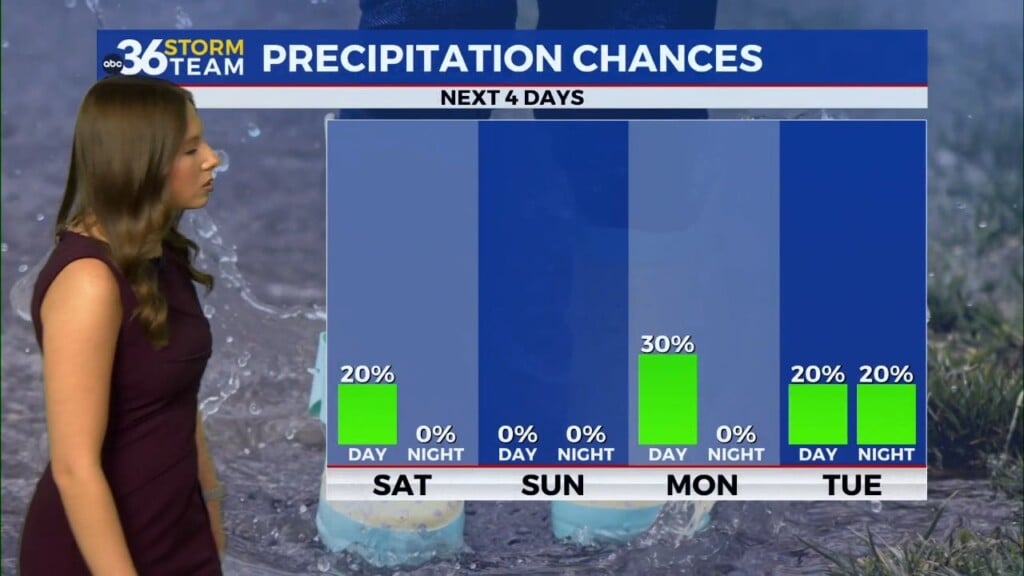
We are in for a major reality check on Saturday as a much advertised wave of low pressure spins down through the Ohio Valley out of the Great Lakes. This system will bring some chilly air along with the chance of a rain/snow mix as temperatures struggle to make it out of the 30s as we kick off the weekend! The overall impact of any legitimate snow showers shouldn’t be great given the recent warm spell we’ve enjoyed some any light accumulations would mainly be on the grassy areas. This system will be in and out in short order with better weather right around the corner.


It will be a quick shift back to a spring-like pattern as high pressure settles across the Deep South on Sunday. This will allow for a breezy south to southwest wind to push milder air back into the commonwealth in short order. Expect a good 20 degree jump in afternoon highs from Saturday to Sunday with readings topping out in the upper 50s to close out the weekend. That upward trend will be a prelude of things to come into the final week of February.

If you enjoy the touch of spring a few days ago then you should really love what is on tap early next week. With a strong south wind staying put and continuing to pump mild air into the Ohio Valley afternoon highs should jump back into the mid-60s on Monday (with an isolated shower chance) before surging to near 70 degrees on Tuesday! All this despite a few scattered showers and storms around so enjoy it while it lasts. We are still monitoring the potential of a few strong storms as the main surface cold front rolls through on Wednesday but the model data isn’t synced up on the exact timing of the front, which would impact the severe weather potential. Overall the latest runs have the system speeding up somewhat so Wednesday’s highs could be around 60 degrees early in the day before falling off behind the front.


This quicker arrival would help to dry us out for “Leap Day” next Thursday (February 29th) with temperatures backing down into the mid-40s for afternoon highs. There is some indication a southern stream system could get cranked up and bring some additional rain chances as we kick off March late next week.

ABC 36 HOUR FORECAST
FRIDAY NIGHT: Clouds increase, rain/snow showers late. Lows in the low 30s.
SATURDAY: Breezy and chilly, a rain/snow mix. Highs in the upper-30s.
SATURDAY NIGHT: Clearing out and cold. Lows in the upper 20s.


