A bit warmer mid-week as the quiet weather hangs around
Afternoon highs should climb into the low 80s in most locations the next couple of days
It was another picture perfect day on Tuesday across Central and Eastern Kentucky. With high pressure in control we enjoyed plenty of sunshine, a few widely scattered clouds and very pleasant afternoon highs into the upper 70s…with a few spots dancing around the 80 degree mark. It was definitely one of those late summer days we look forward to enjoying outside and if you didn’t get the chance Tuesday, we’ve got several more opportunities the next few days. With all the sunshine around, you may have notice some of the fall colors are starting to pop around the area as we head into the fall foliage season.

Wednesday is looking good of course with a similar set-up to what we have enjoyed so far this week. The only change is that high pressure will drift a little father to the northeast, allowing more of a southeast wind which will open the door for temperatures to climb into the low 80s in most spots. This is a few degrees above average for late September but it will still feel good with low humidity levels.

You may have noticed that the amount of daylight is getting less as we close out the summer. Check out the graphic below which shows a little more than 12 hours of daylight this Saturday as the Fall equinox occurs. By comparison, we’ll be down to only 9 hours and 31 minutes of daylight when the winter solstice occurs a few days before Christmas. Lastly, the difference between the most daylight we have (at the summer solstice in late June) to the least amount that we have (at the winter solstice in December) is a whopping 5 hours and 17 minutes of daylight!

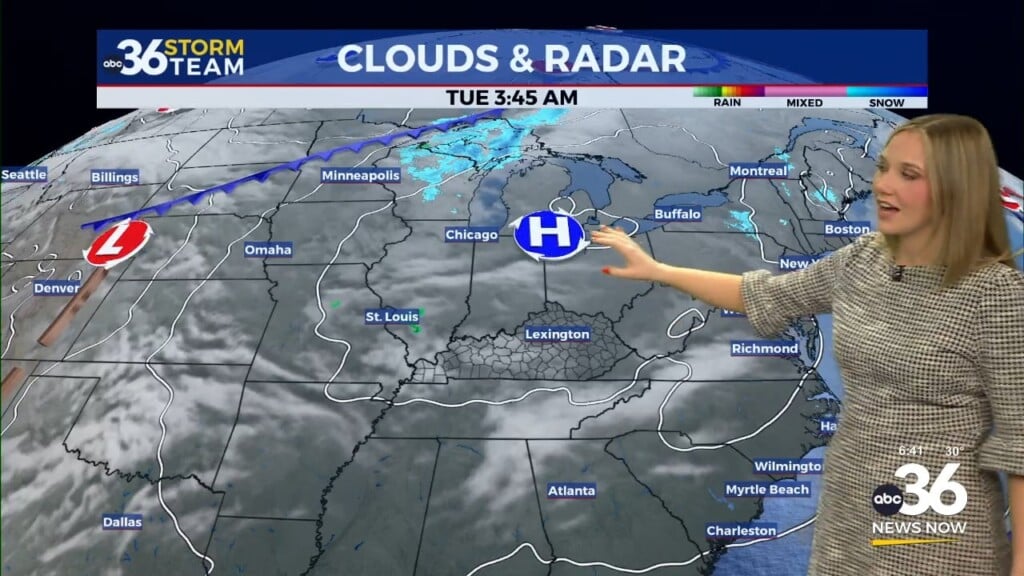
We’ll be on cruise control heading into the late week as the area of high pressure settles over New England. A storm system just to out west may throw a few mid to high levels cloud our way but overall we are still looking good with afternoon highs in the low to mid-80s. A coastal low will slide up the Eastern Seaboard into the weekend and essentially block the system to our west from moving eastward thus keeping things dry.

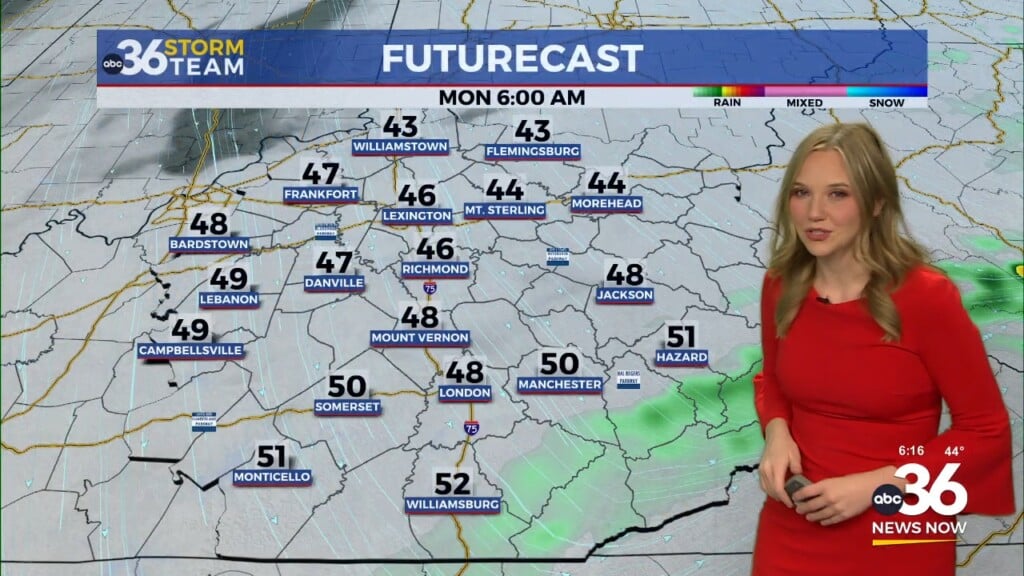
By early next week a frontal boundary to our west will slowly creep into the Ohio Valley increasing our rain chances in the process. Expect a few showers and some thunder late Monday and Tuesday as the system slowly works across the commonwealth. With the clouds and expected rain in the area, temperatures will be held in check with highs into the upper 70s.

ABC 36 HOUR FORECAST
TUESDAY NIGHT: Mostly clear and pleasant. Lows in the mid-50s.
WEDNESDAY: Mostly sunny and warm. Highs in the low-80s.
WEDNESDAY NIGHT: A few clouds and quiet. Lows in the upper-50s.