Feeling more like summer to close out the week
Temperatures will remain warm as the humidity returns by this weekend
It’s been a fantastic week of weather to begin June across Central and Eastern Kentucky and Thursday was no exception. With high pressure in control over the region it was another splendid day with sunshine and warm temperatures. Even though winds were light, the overall flow shifted to the south as the area of high pressure drifted to our east allowing for even warmer air to push into the commonwealth. This boosted temperatures into the mid-80s for afternoon highs and this should be a prelude of things to come the next few days.

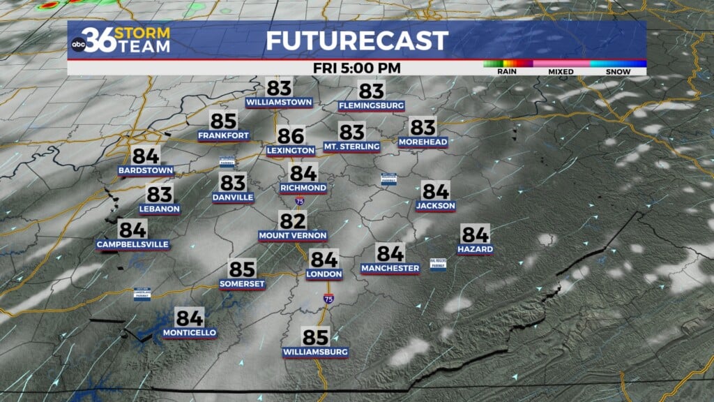
Our great stretch of weather will continue to close out the week on Friday with more sunshine and warmth expected on Friday. High pressure will stay put just to our east so look for a breezy southwest wind through the day so temperatures will be summer-like once again. Afternoon highs will reach the mid-80s and humidity levels will stay manageable for one more day before we see a bit of an increase through the weekend as moisture increases across the area.

It’s definitely going to feel like summer this weekend as our pattern shifts slightly with more humid conditions expected to go along with the early June warmth. High pressure will be sitting to our east as a stalled out front remains well to our northwest so the commonwealth will be sitting in a good spot for dry conditions on Saturday. It should be a good day for any outdoor plans you may have but with afternoon highs pressing into the upper 80s and the increase in the muggy air, you’ll need to slow it down a bit and hydrate during the hottest part of the day. The front should drop close enough on Sunday to produce a few scattered showers and storms to close out the weekend as it taps into the warm and humid air over the region. It shouldn’t be a complete wash-out but you’ll have a few storms to dodge as highs reach the mid to upper-80s.


Early next week the daily scattered shower and storm chances will remain in place, mostly driven by the warmth of the afternoon thanks to the weakening boundary sitting over the region. Anything that develops could produce some locally heavy downpours but at this point we aren’t looking at any widespread rainfall. Afternoon highs will remain above average into mid to upper 80s through the mid-week.

Despite the dry stretch over the last several days, the latest Drought Monitor shows some delayed improvement with this week’s update thanks to some of the rainfall we saw early last week. Areas north of I-64 are out of drought conditions completely (for now) while the southern half of the state saw a significant area dropping back into the moderate drought from the widespread severe drought previously. There are still pockets of severe/extreme drought in that area and we definitely could use some additional rainfall in that part of the state despite the improved readings.

ABC 36 Storm Team 3 Day Forecast
Thursday night: Mostly clear and pleasant. Lows in the upper-50s and low-60s. Wind: SW 5 mph.
Friday: Mostly sunny, breezy and warm. Highs in the mid-80s. Wind: SW 10-15 mph.
Friday night: Fair skies and mild. Lows in the mid-60s. Wind: SW 5-10 mph.