Spring-like air returns quickly into Tuesday
Afternoon highs will press the 80 degree mark late week
With a dry frontal system sliding south of the commonwealth early Monday, it was a pleasant start to the week as a reinforcing shot of cool air behind the front held temperatures in check despite a good bit of sunshine around. Afternoon highs only managed to reach the upper 50s and low-60s, which is about 8 to 10 degrees below average for this time of the year but we’ll see a quick warm-up heading into Tuesday.

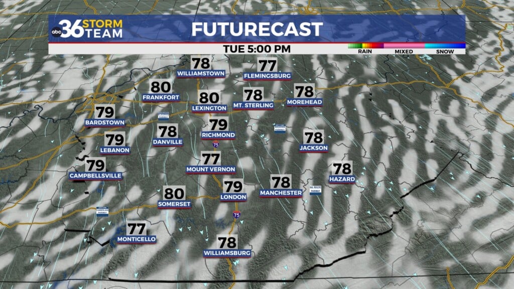
Look for another chilly start into Tuesday morning with some of the sheltered valley areas in the east potentially dropping into the low to mid-30s. A Frost Advisory is out for counties just east of Lexington with Freeze Warnings for the Eastern Kentucky mountains through 9am Tuesday morning so protect those plants to be on the safe side. High pressure will slide off to our east allowing for a return southwest flow to kick in Tuesday bringing a rapid return of milder air to the commonwealth. With plenty of sunshine around afternoon highs should jump all the way back into the mid-70s so look for readings to be a solid 15 degrees plus milder than what we saw to begin the week. It should be comfortable again for any outdoor activities for sure.


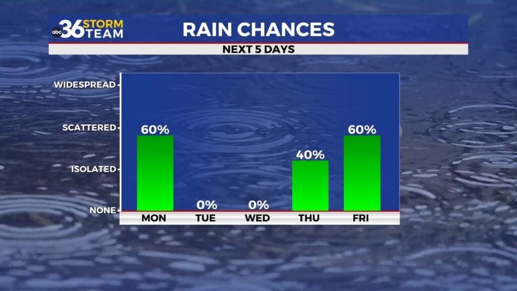
A weak wave of energy will slide through the Ohio Valley into the mid-week so look for a low end chance of a few showers and storms, especially across the northern half of the state. Temperatures still look good with highs in the mid-70s although a bit more cloud cover will hold afternoon highs in check as a result. We’ll be back to sunshine and a southwest flow by Thursday so look for another delightful day as temperatures climb back toward the 80 degree mark in most spots.


A cold front will be on the move and headed into the Ohio Valley as we close out the week on Friday but we should be able to squeeze one more good day in before things get more active and unsettled for the upcoming weekend. Much of Friday looks dry and warm with afternoon highs climbing back to around 80 degrees for afternoon highs. While a late shower or storm may be possible, the bulk of the rain chances will hold off until after dark. If you have weekend plans you may need to adjust them a bit as we are looking at the potential of scattered showers and storms on occasion. The front will stall out just to our south and with a few waves of energy moving along it, rain and storms will be sticking around for a few days. While the timing could be better with it being a spring weekend, we could use the rain given the dry/drought conditions across the area. Afternoon highs will back off a bit into the mid-70s with the clouds and rain around.


ABC 36 Storm Team 3 Day Forecast
Monday night: Mostly clear, frost possible east. Lows ranging from the mid-30s east to around 40 degrees central. Wind: SE 5-10 mph.
Tuesday: Mostly sunny, breezy and milder. Highs in the mid-70s. Wind: SW 10-15 mph.
Tuesday night: Fair skies and pleasant. Lows in the mid-50s. Wind: SW 10-15 mph.