Cooler air returns this weekend
Look for low end rain chances and a few snowflakes as well
After a sneak preview of our spring severe weather season with hail producing thunderstorms across the area on Thursday, we saw a much quieter Friday around Central and Eastern Kentucky. A few scattered clouds in the morning gave way to sunshine the rest of the day but it was definitely on the breezy to windy side. Brisk west winds gusting over 40 miles per hour at times added to a slightly cooler feel to the air as afternoon highs managed to recover a few degrees into the mid-50s here in the Bluegrass with low to mid-60s across the south and east before tailing a bit late in the day.
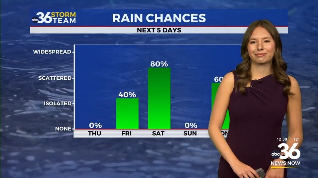
Heading into the weekend a wave of energy is set to slide south of the commonwealth so we should wake up to a few scattered clouds around the area, especially in Southern Kentucky where an early morning shower can’t be ruled out. While the bulk of the moisture is expected to remain to our south and Saturday looks to be mainly dry during the daylight hours, the aforementioned wave will get close enough to possibly produce a few light rain showers by Saturday evening. Afternoon highs will be in the upper 40s, which is right around average for this time of the year.
Colder air will spill into the Ohio Valley in the wake of the departing wave thanks to a northwest flow kicking in as we roll into Sunday. It looks to be a case of where the cold air should catch some of the lingering moisture Saturday night and into Sunday so a few snow showers will be possible given that temperatures should be in the upper 20s to begin the day. The second half of the weekend will be the long awaited reality check that we are still in February as afternoon highs only reach the mid-30s. With the northwest flow aloft bringing some moisture to the south off of the Great Lakes, look for some clouds and even a few snow showers lingering into the mountains of Eastern Kentucky on Monday. There could be enough for a light coating in a few spots there, but otherwise the impact should be minimal. Temperatures will remain quite cold with afternoon highs only in the low to mid-30s so get those heavier coats ready once again.
High pressure to our south should help bring a return of some sunshine heading into Tuesday along with a return flow out of the southwest, which should help our temperatures rebound nicely beginning on Tuesday. After a cold start with morning lows into low 20s, afternoon highs will rebound closer to 40 degrees. This is still below average for late February but at least we’ll be headed the right direction. A frontal system off to the northwest may dive into the Ohio Valley into the middle part of next week so southwest winds ahead of it should push us all the way back into the low-50s by Wednesday afternoon. This warm-up comes with a trade off as our scattered shower chances ramp up toward the end of the next week with the frontal boundary creeping through the region.
ABC 36 Storm Team 3 Day Forecast
Friday night: A few clouds and cold. Lows in the mid-30s. Wind: W 10-15 mph.
Saturday: Partly cloudy and cooler. Highs in the upper-40s. Wind: NW 5-10 mph.
Saturday night: Mostly cloudy with a few flakes. Lows in the upper-20s. Wind: NW 5-10 mph


