A dry and mild Valentine’s Day on tap as rain approaches
The second half of the weekend looks damp across the area
After another chilly start to the day with temperatures dipping down into the low to mid-20s, we enjoyed a very pleasant finish to the week on Friday across Central and Eastern Kentucky. With high pressure giving way to the southeast but still in control of our weather, sunshine was abundant along with a light breeze out of the southeast. This allowed afternoon highs to climb into the low 50s in most locations, which felt fantastic especially when you think back to the consistent deep freeze we dealt with for several weeks. The good news is that the above average temperatures should continue as we head into the weekend.

Overall Valentine’s Day looks pretty sweet this year as most if not all of us will enjoy a dry and tranquil day from start to finish. With a storm system getting its act together to our southwest, do expect some mid to high level clouds to stream in and increase as the day wears on after some morning sunshine but it should be rain-free. Even with the clouds around, afternoon highs will stay above the curve for the middle part of February with the majority of the area reaching the mid-50s for afternoon highs. If you have holiday plans into the evening hours as most folks probably will, you may want to take an umbrella for areas west of Lexington as a few showers could creep in as we approach Midnight but hopefully we’ll get through that window without any rainfall.


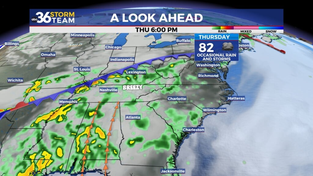
The second half of the weekend looks damp and dreary as a wave of low pressure slides by to our south on Sunday. With plenty of moisture being pulled up from the Gulf, look for a pretty steady rain, at least off and on through the day so you’ll need the rain gear if you are going to be out and about. Rainfall totals should be around 1″ for most spots with Southern Kentucky seeing potentially a bit more. Given the recent snow/ice melt, this additional moisture could create a few minor flooding issues in the typical places that see it so just keep that in mind. With the clouds and rain around, afternoon highs will drop back a few degrees into the upper 40s and low 50s. Heading into President’s Day on Monday, it’s back to dry conditions as high pressure builds in and we’ll see more mild air with highs climbing back into the mid-50s, so conditions should be nice if you have the holiday off.


A ridge of high pressure looks to build into the eastern part of the country through the middle of next week, bringing even warmer temperatures to Central and Eastern Kentucky during that time frame. Much of the data is showing some cloudiness around as a few waves of energy ride along a weak frontal boundary off to our north, but with a breezy southwest wind in place over the Ohio Valley, temperatures will still manage to reach the low and mid-60s across the board which is a good 15 to 20 degrees above average for this time of the year. Look for a very low end shower chance by next Thursday and Friday with the aforementioned boundary dropping a little farther south but right now this doesn’t appear to be anything real organized so plan on enjoying the extended break from the cold once again.


ABC 36 Storm Team 3 Day Forecast
Friday night: Mostly clear, not as cold. Lows in the low-30s. Wind: S 5 mph.
Valentine’s Day: Partly sunny with more clouds late. Highs in the mid-50s. Wind: S 5 mph.
Saturday night: Cloudy with rain moving in. Lows in the low-40s. Wind: SE 5 mph.