More pleasant weather on tap to welcome October
Afternoon highs look nice in the low to mid-80s in most spots
It was a delightful finish to the month of September on Tuesday across Central and Eastern Kentucky with more quiet weather across the board. Abundant sunshine and a nice northeast breeze made for a delightful final day of the month as most locations warmed up into the mid-80s for afternoon highs. While these readings are a good 10 degrees above average for this time of the year, the lack of humidity made things feel pretty comfortable to be out and about. Despite lengthy dry stretches throughout September, we did manage to finish the month just below average for rainfall here in Lexington.
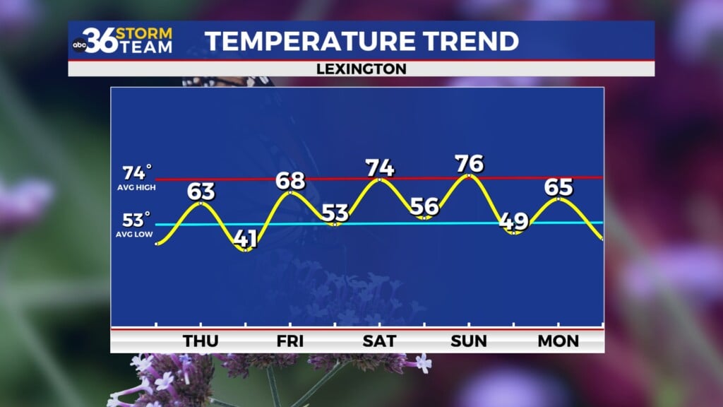
Look for more of the same as we kick off October on Wednesday as a broad area of high pressure continues to dominate. After starting the morning with temperatures in the mid-50s, look for a significant recovery as afternoon highs continue to stay well above the curve into the low to mid-80s. These large spreads between the early morning lows and the afternoon highs are pretty typical during these quiet weather patterns during early fall so dress accordingly.
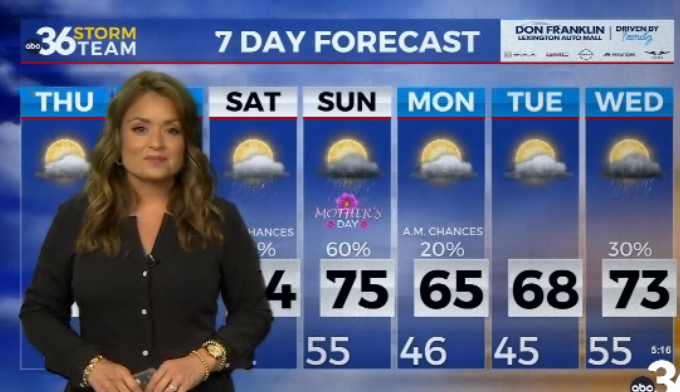
The first few days of October should feature more of the same as high pressure continues to control the weather across the eastern part of the country. The persistent northeast wind should help shave a few degrees off of afternoon highs but temperatures still look unseasonably warm as readings reach the low-80s in most spots. Looking ahead to high school football on Friday, we should be in store for yet another fantastic evening across the region for all the games as we are already in week 7 of the season. So far we’ve only had one Friday evening of disruptive weather through the season so far and this will be another week of non-impactful weather.
The upcoming weekend looks nice for all the fall festivals that are set to continue across the commonwealth over the first weekend of October. look for more sunshine and highs remaining in the low 80s. Some of the data is showing a bit of a return flow kicking in late in the weekend and into early next week as a cold front approaches from the northwest. After another extended stretch of dry weather, we are definitely going to need the rain and it appears we may work a few showers back in the mix as a result. If this scenario plays out, afternoon highs will back down into the upper 70s thanks to some additional cloudiness and possible showers in the area.


